Saint Kitts rewards travelers who look beyond beaches with a compact but remarkably varied collection of natural monuments shaped by volcanoes, reefs, rain, and time. In this guide to discovering Saint Kitts’ natural monuments, “natural monuments” refers to distinct landforms, coastal features, forests, springs, and marine sites valued for ecological importance, scenic character, and cultural meaning. On an island just 68 square miles, these places sit close together, yet each reveals a different part of the island’s environmental story. Some are obvious landmarks, like Mount Liamuiga and the black-sand coast below old lava fields. Others are quieter: a ghaut lined with giant trees, a salt pond holding shorebirds, or coral gardens offshore that support fisheries and snorkeling alike.
This topic matters because Saint Kitts is often marketed through cruise itineraries and resort views, while its natural heritage gets summarized too quickly. That shortchanges visitors and, more importantly, local conservation priorities. I have planned field itineraries here, and the biggest mistake first-time visitors make is assuming the island can be “done” in a day. In reality, Saint Kitts contains layered ecosystems tied to rainfall gradients, elevation, volcanic soils, and former sugar lands now returning to bush and secondary forest. Understanding these monuments helps travelers make better choices about where to hike, when to visit, and how to reduce pressure on fragile sites. It also gives context for related pages across a broader Nature and Wildlife hub, from birdwatching and marine life to rainforest walks, scenic lookouts, and responsible ecotourism planning.
At a practical level, this hub article serves as the starting point for miscellaneous natural sites that do not fit neatly into a single trail, beach, or wildlife category but deserve attention. Expect direct answers to common questions: what are the most important natural monuments in Saint Kitts, where are they, what makes them significant, and how should you experience them safely? The essentials are straightforward. The island’s defining monuments include its dormant stratovolcano, crater rim forest, lava-formed coastlines, Atlantic and Caribbean viewpoints, offshore reefs, wetlands such as salt ponds and mangrove margins, and dramatic erosion-carved features along the Southeast Peninsula. Together they explain why Saint Kitts feels larger, wilder, and more geologically expressive than many visitors expect.
Mount Liamuiga and the volcanic heart of the island
The most important natural monument in Saint Kitts is Mount Liamuiga, the island’s dormant stratovolcano and highest point at about 1,156 meters, or 3,792 feet. Everything radiates from it: drainage patterns, soil fertility, cloud formation, forest structure, and many of the island’s best vistas. When travelers ask which site they absolutely should understand before exploring the rest of Saint Kitts, this is the answer. The mountain’s broad summit crater, often filled with vegetation and mist, is the clearest expression of the island’s volcanic origin. Fertile slopes created ideal conditions for historical sugar cultivation at lower elevations, while upper elevations retained wetter forest communities that now anchor hiking and conservation interest.
A guided hike from the Belmont or Newton Ground side usually takes several hours and should not be underestimated. Trails can be muddy, root-bound, and steep near the upper sections, where ropes are sometimes used for support. In field planning, I treat Mount Liamuiga less like a casual walk and more like a mountain outing in tropical conditions: start early, carry more water than expected, and avoid summit attempts during heavy rain or low visibility. The payoff is substantial. From breaks in the cloud, hikers can sometimes see neighboring islands including Statia, St. Barts, Saba, and St. Martin. The forest itself is part of the monument, with tree ferns, towering trunks, epiphytes, and monkeys frequently observed along the route.
The ecological significance of Liamuiga extends beyond scenery. Elevation creates cooler temperatures and moisture capture, supporting habitat not found on drier coasts. This makes the mountain central to watershed health. Ghouts descending from upper slopes carry runoff through settlements and agricultural areas, so trail erosion and littering at higher elevations have wider consequences. For visitors exploring the Nature and Wildlife hub, Mount Liamuiga connects directly to rainforest hiking, endemic and resident birdlife, and the island’s geology. If time allows only one deep inland experience, choose this one, because it frames nearly every other natural monument on Saint Kitts.
Coastal landforms, black-sand shores, and the Southeast Peninsula
If Liamuiga explains the island from the center, the coasts explain it from the edges. Saint Kitts has both Caribbean and Atlantic exposures, and the contrast is one of its most useful natural lessons. On the Caribbean side, waters are generally calmer, supporting sheltered bays and easier marine access. On the Atlantic side, wave energy is stronger and shorelines can feel rawer, with visible erosion, rougher surf, and dramatic meeting points of sea and rock. Black-sand beaches, especially in areas influenced by volcanic sediments, are among the most immediate signs that Saint Kitts is not just another pale-sand Caribbean destination.
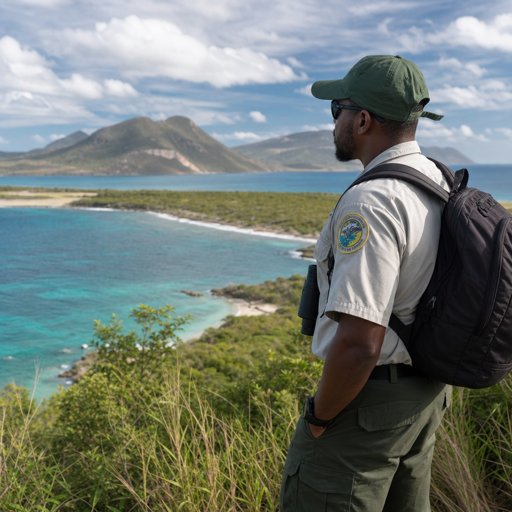
The Southeast Peninsula is especially valuable as a natural monument zone because it concentrates several landscape types in a relatively short drive. Here, narrow roads thread between hills, salt ponds, scrub vegetation, beaches, and elevated lookouts where the Atlantic and Caribbean can be viewed in close succession. Timothy Hill is one of the island’s most photographed points for exactly this reason: it demonstrates how topography pinches the land into a visual corridor between two water bodies. In practical itinerary design, this area works well for travelers who cannot commit to a mountain hike but still want a strong sense of geological form.
Several coastal features here also show the long transition from sugar cultivation to semi-natural regeneration. Dry forest, thorn scrub, and grassland mosaics are not always dramatic at first glance, yet they support reptiles, birds, and pollinators adapted to heat, salt, and seasonal dryness. The peninsula also leads toward The Narrows, the channel between Saint Kitts and Nevis, where currents, views, and maritime geography create one of the island’s most distinct settings. For a sub-pillar hub, these locations are essential because they connect future deeper articles on viewpoints, beaches, and coastal ecology into one coherent landscape story.
| Natural monument area | What defines it | Best way to experience it | Main caution |
|---|---|---|---|
| Mount Liamuiga | Dormant volcano, crater forest, high-elevation views | Guided hike in early morning | Steep, muddy sections and rapid weather changes |
| Southeast Peninsula | Dual-coast vistas, salt ponds, dry coastal habitats | Scenic drive with short lookout stops | Heat exposure and limited shade |
| Black-sand beaches | Volcanic sediments and darker shorelines | Photography, beach walk, shoreline interpretation | Stronger surf on some Atlantic-facing stretches |
| Offshore reefs and bays | Coral communities, seagrass, fish habitat | Snorkeling or guided boat excursion | Coral damage from standing or fin contact |
Wetlands, ghouts, and overlooked ecological landmarks
Not every natural monument in Saint Kitts rises dramatically above the landscape. Some of the most important are low, linear, or seasonal, which is why casual visitors miss them. Wetlands, salt ponds, mangrove edges, and ghouts deserve much more attention than they receive. A ghaut is a steep-sided watercourse or ravine common across the eastern Caribbean, often dry or reduced outside heavy rains but still ecologically important. On Saint Kitts, ghouts function as drainage channels, wildlife corridors, and microhabitats with cooler, shadier conditions than surrounding land. Mature trees in these corridors can support birds, insects, and small reptiles even where nearby areas are more disturbed.
Salt ponds on the Southeast Peninsula and in other low-lying coastal zones are equally significant. They may look empty at noon in dry weather, but timing changes everything. Early morning or late afternoon can reveal herons, egrets, sandpipers, and other water-associated birds using shallow margins for feeding or resting. During migration periods, these habitats become more valuable still. From a conservation perspective, wetlands also buffer runoff, hold sediment, and provide nursery functions where mangroves or adjacent seagrass systems persist. They are modest in scale compared with famous Caribbean mangrove forests, yet on a small island every wetland hectare matters.
These quieter landmarks also help explain the island’s recovery from intensive plantation-era land use. Secondary growth around abandoned fields, ghauts, and pond margins is where visitors often begin to see ecological succession at work: pioneer plants stabilize soil, birds spread seeds, and structure gradually thickens. That process is not pristine wilderness, but it is real ecological value. For travelers interested in nature beyond postcard scenes, these are the places that reveal resilience. Bring binoculars, move slowly, and treat them as destinations rather than roadside filler. They are part of the reason Saint Kitts supports richer biodiversity than quick summaries suggest.
Marine monuments: reefs, bays, and underwater topography
Saint Kitts’ natural monuments continue offshore, and ignoring the marine dimension gives an incomplete picture of the island. Coral reefs, rocky underwater slopes, seagrass beds, and sheltered bays form a connected system that supports biodiversity, tourism, and fisheries. On the leeward side, calmer conditions often make snorkeling easier, while certain dive sites reveal volcanic boulders, reef fish assemblages, and healthy coral patches. Operators frequently identify areas by nearby bays or coastal landmarks, but the broader point is that the island’s underwater topography mirrors its terrestrial origin: steep relief, volcanic substrate, and localized shelter shape where marine life thrives.
In my experience, visitors often assume all Caribbean snorkeling is interchangeable. Saint Kitts proves otherwise. A sheltered bay with patch reef and seagrass may host juvenile fish, sea urchins, and grazing species that indicate habitat complexity, while a more exposed rocky site can present stronger surge, larger sponges, and different coral growth forms. Even where coral cover is not pristine, the educational value remains high because you can see how reef systems function under pressure from warming seas, storms, and human use. Responsible guides make a major difference here by enforcing no-touch practices and selecting sites appropriate to conditions.
Marine monuments also carry a strong economic argument for protection. Healthy reefs reduce wave energy, support local fishing livelihoods, and strengthen the tourism product beyond beach lounging. Damage from anchors, careless snorkeling, sediment runoff, and coastal pollution is cumulative, not isolated. That is why visitors should prioritize operators who use moorings, brief guests properly, and avoid overcrowding fragile spots. Within the wider Nature and Wildlife structure, these sites connect naturally to marine life guides, snorkeling pages, and conservation-focused itineraries. If Saint Kitts is to be understood as a living island system rather than a resort backdrop, its underwater monuments must be counted among its most important natural assets.
How to explore responsibly and build a better island itinerary
The best way to discover Saint Kitts’ natural monuments is to match site type with weather, fitness, and daylight rather than trying to cram every landmark into a single loop. For example, a strong first day might pair the Southeast Peninsula with coastal lookouts and a wetland stop, followed by a mountain hike on a cooler morning, and a reef excursion only when marine conditions are favorable. This sequencing sounds simple, but it solves common problems: hikers avoid midday heat, photographers get better light, and snorkelers avoid rough water chosen for convenience instead of safety. A good itinerary respects the island’s environmental rhythms.
Responsible exploration begins with guides. For Mount Liamuiga, use an experienced local guide because trail conditions can change quickly and route knowledge matters. For marine sites, choose licensed operators with safety briefings, reef-safe practices, and clear weather judgment. On land, stay on marked paths where they exist, especially on erodible slopes and coastal edges. Do not remove stones, shells, coral, or plants. Wear sturdy footwear for hikes, sun protection for the peninsula, and insect repellent for wetter inland areas. Carry out all waste, including fruit peels, which people wrongly assume are harmless in natural settings.
It also helps to set expectations accurately. Saint Kitts is lush in places, but not every monument is dramatic at every hour. Cloud can close Mount Liamuiga’s views. A salt pond may appear quiet until bird activity picks up. A black-sand beach can be visually striking even when swimming conditions are poor. The reward for patience is a more truthful encounter with the island. Use this hub as your foundation, then branch into detailed pages on rainforest hikes, birdwatching, scenic drives, beaches, and marine experiences. The more context you bring, the more these natural monuments reveal.
Discovering Saint Kitts’ natural monuments means seeing the island as a connected landscape rather than a collection of stops. Mount Liamuiga explains the volcanic core, the Southeast Peninsula reveals coastal contrast, black-sand shores point to geological origin, wetlands and ghouts show ecological resilience, and reefs complete the picture offshore. Together, these places form the essential “miscellaneous” layer within a Nature and Wildlife hub because they cut across categories and link them. A traveler interested in birds, hiking, snorkeling, photography, or conservation will keep returning to the same truth: the island’s most memorable experiences come from understanding how its systems fit together.
The main benefit of using a hub approach is clarity. Instead of searching randomly for one beach, one trail, or one viewpoint, you can organize your trip around natural monument types and build smarter days. Start with the mountain if you want scale and forest. Choose the peninsula if you want broad scenery and accessible variety. Add wetlands for birdlife and quieter observation. Include a reef excursion to understand the marine half of the island. This method produces a richer itinerary and supports operators and guides who treat nature as an asset worth protecting, not simply a backdrop for quick photos.
Saint Kitts is small enough to explore efficiently and complex enough to reward repeat visits. That combination is rare. Use this page as your starting map for the subtopic, then move deeper into the related Nature and Wildlife articles that expand each environment in detail. Plan carefully, go with experienced local guides where needed, and give each site enough time to speak for itself. When you do, Saint Kitts’ natural monuments become more than attractions; they become the framework for understanding the island.
Frequently Asked Questions
What counts as a natural monument in Saint Kitts?
In the context of Saint Kitts, a natural monument is more than just a pretty viewpoint or a popular beach. The term generally refers to a distinct natural feature or landscape with ecological, geological, scenic, or cultural importance. On an island as compact as Saint Kitts, these monuments can include volcanic peaks, forested slopes, black-sand or rocky coastal formations, freshwater springs, caves, offshore reefs, and marine habitats that support local biodiversity. What makes them “monuments” is not necessarily size, but significance. A small coastal outcrop shaped by centuries of wave action can be just as meaningful as a major mountain ridge if it tells part of the island’s environmental story.
Saint Kitts is especially rich in these kinds of sites because its landscape was formed by volcanic activity and then continually reshaped by tropical rainfall, trade winds, erosion, and reef growth. That combination creates dramatic elevation changes, fertile rainforest zones, and varied shorelines within a very short distance. Many natural monuments also overlap with places of cultural memory, traditional land use, and community identity. In practical terms, travelers exploring Saint Kitts should think broadly: the island’s natural monuments are not limited to one famous landmark, but include a network of inland and coastal environments that reveal how geology, climate, and history come together.
Which natural areas in Saint Kitts are most worth visiting first?
If you are choosing where to begin, start with places that show the island’s range in a manageable way. Mount Liamuiga is one of the most important natural landmarks because it is the dormant volcano that helped shape the island itself. Hiking its slopes introduces visitors to changing vegetation zones, cloud forest conditions at higher elevations, and the deep crater that reminds you of Saint Kitts’ volcanic origins. For many travelers, it is the clearest introduction to the island’s interior landscape and one of the most rewarding nature experiences available.
After that, the Central Forest Reserve deserves attention for its dense tropical vegetation, birdlife, and role as an ecological core of the island. It gives visitors a better understanding of how rain, elevation, and fertile volcanic soils support lush habitat in the interior. Along the coast, the Southeast Peninsula offers a striking contrast, with sweeping views, salt pond environments, rocky shorelines, and marine areas where the Atlantic Ocean and Caribbean Sea feel dramatically close. Brimstone Hill’s surrounding natural setting, although often discussed for its fortress, also reveals the relationship between human settlement and the island’s terrain. If marine life interests you, reefs and nearshore waters around the island are equally important natural monuments, offering coral ecosystems, fish habitat, and another perspective on how Saint Kitts’ landscapes extend below the surface. Together, these sites provide a strong first overview of the island’s forests, volcanoes, coastlines, and marine environments.
Is it possible to explore Saint Kitts’ natural monuments without being an experienced hiker?
Yes, absolutely. One of the advantages of Saint Kitts is that its natural variety is accessible even to travelers who are not advanced hikers. While certain experiences, such as the climb to Mount Liamuiga’s crater, are best suited to people with good fitness and a guide, many other natural monuments can be appreciated through scenic drives, short walks, coastal stops, guided tours, and boat excursions. Because the island is relatively small, you can move from rainforest-edge views to dramatic shoreline scenery in a short period of time without committing to a full day of strenuous trekking.
Travelers with moderate mobility can still enjoy viewpoints along the Southeast Peninsula, explore gentler nature trails in lower elevations, visit beach and coastal areas with notable rock formations, and take snorkeling or glass-bottom excursions to experience marine monuments with minimal physical effort. Hiring a knowledgeable local guide is especially helpful because they can match stops to your comfort level while explaining the environmental and cultural significance of each place. The key is to choose experiences intentionally. Saint Kitts rewards both adventurous hikers and relaxed sightseers, and many of its most memorable natural features can be understood and appreciated without extreme physical demands.
What is the best time of year to visit Saint Kitts for nature and outdoor exploration?
The best time depends on what kind of nature experience you want, but in general the drier months are the easiest for broad outdoor exploration. During the drier season, trails are often less muddy, visibility from scenic overlooks can be clearer, and conditions for hiking, coastal sightseeing, and boat trips are typically more comfortable. This is an excellent time to combine inland and coastal natural monuments in a single itinerary, especially if you want reliable access and easier logistics.
That said, wetter periods also have advantages. Rain nourishes the island’s forests, intensifies the green landscapes, and can make rivers, springs, and vegetation-rich areas feel especially vibrant. The trade-off is that some trails become slick, cloud cover may obscure summit views, and weather can shift quickly. Marine conditions can also vary depending on wind and sea state. For most travelers, the ideal approach is not to focus only on the season, but to plan with flexibility. Start hikes early in the day, wear proper footwear, bring water and rain protection, and check local conditions before heading inland or out on the water. Saint Kitts is a year-round destination for nature, but preparation matters because the same weather patterns that make the island so lush also shape how accessible different natural monuments are on any given day.
How can travelers explore Saint Kitts’ natural monuments responsibly?
Responsible exploration begins with understanding that Saint Kitts’ natural monuments are not just attractions; they are living ecosystems and, in many cases, places with cultural meaning for local communities. Staying on marked paths helps protect fragile vegetation and reduces erosion, especially in mountainous and rainforest areas where soils can be disturbed easily. Avoid removing shells, stones, plants, or coral, and never stand on or damage reef structures while snorkeling or diving. Even small actions by many visitors can degrade habitats over time, particularly on a small island where ecosystems are interconnected and recovery may be slow.
It is also wise to support local guides, conservation-minded tour operators, and businesses that respect the island’s environment. Guides often provide essential safety knowledge, but they also deepen your understanding of how volcanic geology, coastal processes, and biodiversity shape each site. Bring reusable water bottles when possible, dispose of waste properly, use reef-safe sun protection if you are entering marine environments, and keep noise to a minimum in forest and wildlife areas. Respect for weather conditions is part of responsible travel too; avoiding risky behavior on steep trails or rough coastlines helps protect both visitors and rescue resources. Ultimately, the best way to experience Saint Kitts’ natural monuments is to treat them as places to learn from, not simply consume. That mindset leads to better travel experiences and helps preserve the island’s landscapes for future visitors and residents alike.