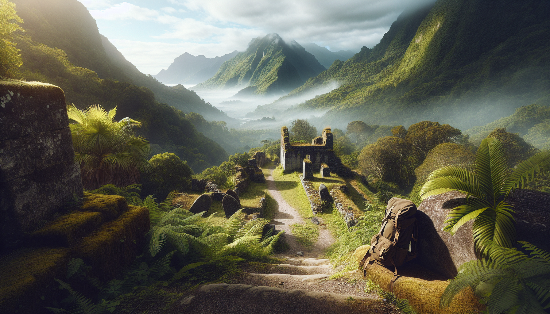
Nevis rewards hikers with something rare in the Caribbean: trails where rainforest, estate ruins, and island history share the same path. Exploring the ruins on historical hikes in Nevis is not just an outdoor activity; it is one of the clearest ways to understand how this small volcanic island was shaped by sugar, slavery, trade, religion, and resilience. Historical hikes in Nevis usually combine moderate trekking with visits to former plantations, windmill sites, stone cisterns, abandoned great houses, churches, and forgotten roadways that once linked estates to coastal ports. For travelers interested in adventure and activities, this miscellaneous hub matters because many of Nevis’s most memorable experiences do not fit into a single category like beach time, heritage tourism, or mountain hiking. They sit at the intersection of all three. I have walked these routes with local guides and independently, and the difference between simply seeing ruins and actually reading the landscape is enormous. Once you know what a boiling house looked like, why windmills sat on ridges, or how estate villages were positioned downhill from great houses, the island becomes legible in a new way. This guide explains what historical hikes in Nevis include, which sites are most rewarding, how to choose a route, and what to expect in terms of access, terrain, weather, and cultural context.
What counts as a historical hike in Nevis
A historical hike in Nevis is any walk where the destination or route has direct heritage value, not just scenic value. On Nevis, that often means former sugar plantations from the seventeenth through nineteenth centuries, ruins of processing works, old churches, cemeteries, military viewpoints, and settlement roads. Because Nevis was one of the earliest and wealthiest British sugar colonies in the Leeward Islands, its landscape still holds dozens of visible remnants. You may see a circular stone windmill tower above a field, a chimney stack hidden in bush, or dressed stone foundations near mango trees and tamarind. Many of these remains sit on private land or near active residences, so the best hikes are those done with permission or with a knowledgeable local operator.
The term also includes walks through Charlestown and surrounding villages where built heritage and topography connect. For example, a route may begin near the Bath Hotel, continue past the Jewish Cemetery, climb inland on an old estate road, and end at plantation ruins that illustrate how elite residences and agricultural works were separated. In practical terms, historical hikes in Nevis tend to be shorter and more varied than a summit trek to Nevis Peak. They are less about elevation gain and more about interpretation. Expect frequent stops, uneven footing, thorny vegetation in drier areas, and the need to slow down to notice architectural clues.
Why plantation ruins matter on the trail
Plantation ruins are not decorative relics. They are evidence of an economic system that generated immense wealth for owners while relying on enslaved African labor under brutal conditions. Any serious guide to historical hikes in Nevis should state that plainly. The surviving structures typically include windmills used to crush cane, boiling houses where juice was clarified and concentrated, curing houses where sugar crystals were dried, cisterns, retaining walls, and great house remains. Sometimes a site retains only masonry platforms and scattered cut stone, but even partial remains reveal how the plantation worked.
When I hike estate lands on Nevis, the most important shift for visitors is learning to look beyond the postcard image of a romantic ruin. A windmill tower on a green hillside can be beautiful, but its purpose was industrial. The surrounding slopes were once intensely cultivated, often stripped and replanted for sugar cane. Estate villages, paths, and provision grounds formed part of that system. Understanding this history adds weight to every stop and also makes the island’s later transitions clearer, from sugar decline to small-scale agriculture, tourism, and conservation. In plain terms, the ruins matter because they tell the truth about how Nevis was built.
Best areas for historical hikes in Nevis
The most rewarding areas are usually the former estate belts between the coastal plain and lower mountain slopes. Around Gingerland, St. James Windward, and the inland roads above Charlestown, hikers can find concentrations of plantation remains, old churches, and wide views that explain why estates were placed where they were. The choice of location was practical. Owners wanted cane fields on usable slopes, access to roads and ports, exposure to wind for mills, and enough elevation for cooler great house sites.
New River is a strong example. The New River Estate area contains one of the island’s most recognizable windmill towers and coastal industrial remains linked to the sugar trade. A hike here can combine sea views, archaeology, and discussion of export infrastructure. Montpelier and nearby estates offer another layer, especially for visitors interested in the connection between plantation landscapes and later hospitality sites. Around Fountain and the Spring Hill area, inland routes can reveal cisterns, foundations, and roads that many visitors would miss from a car. Even if a specific ruin is modest, the broader landscape often tells the better story: where labor happened, where owners lived, and how goods moved downhill to the coast.
Standout sites and what they reveal
Several sites repeatedly justify the effort. The Bath area matters because it links colonial health culture, early tourism, and island settlement. The Bath Hotel, built in the eighteenth century near hot springs, reflects Nevis’s role as a destination long before modern resorts. A walking route that includes Bath, the spring area, and Charlestown heritage sites gives context for elite travel and social life. The Jewish Cemetery in Charlestown is another key stop. Its surviving gravestones, some dating to the seventeenth century, point to the Sephardic Jewish merchant community that played a notable role in Caribbean trade.
Plantation ruins such as New River, Eden Brown vicinity sites, and smaller unnamed windmill or boiling house remains reveal the industrial side of island life. Churches in villages like St. Thomas and St. James can also anchor a hike because parish organization shaped daily life after emancipation as well as before it. Trails are rarely marked as heritage trails in the formal sense, so the quality of the experience depends on interpretation. The best local guides identify coral stone, lime mortar, cistern placement, and road alignments, then connect those details to labor systems, hurricanes, drought, and economic decline. That is what turns a walk into a historical hike rather than a simple ruin hunt.
How to choose the right route
The right route depends on your fitness, interests, and tolerance for heat. If your priority is architecture and easy access, choose a low-elevation walk near Charlestown, Bath, or a road-accessible estate. If you want a stronger hiking feel with heritage layered into the experience, select a mid-slope plantation route in Gingerland or the Windward side where old works, field walls, and forest edges meet. If photography matters most, morning hikes to coastal estate ruins usually produce better light and less haze.
| Route type | Best for | Typical features | Difficulty |
|---|---|---|---|
| Charlestown and Bath heritage walk | First-time visitors | Historic buildings, cemetery, hot spring area, short road sections | Easy |
| Coastal estate ruin hike | History and photography | Windmill towers, sea views, exposed terrain, trade context | Easy to moderate |
| Inland plantation trail | Active hikers wanting depth | Old roads, cisterns, foundations, village history, shade patches | Moderate |
| Mixed heritage and rainforest route | Repeat visitors | Estate remains, orchard remnants, steeper sections, ecology links | Moderate to strenuous |
I usually tell travelers to underestimate the effect of humidity and overestimate how long interpretation stops will take. A route that looks short on a map can easily become a half-day outing once you factor in discussion, photographs, and careful footing around ruins.
Guided hikes versus self-guided exploration
Guided hikes are usually the better choice in Nevis for one simple reason: access and interpretation. Many ruin sites are not clearly signposted, some lie behind homes or across private tracks, and others are easy to misread without context. A guide can also explain which walls are original, which were rebuilt, and which stories are well documented rather than local legend. On an island where oral history still matters, that distinction is important. Reputable guides also know weather patterns, trail conditions, and when vegetation has made a route impractical.
Self-guided exploration still has a place, especially in Charlestown and Bath where the heritage fabric is more legible and public access is clearer. If you go independently, use an offline map, carry enough water, wear proper shoes, and assume that an unmarked track is not automatically public. Ask before entering estate land. Do not climb unstable walls or towers. The safest approach is hybrid: take one guided historical hike early in your trip, then use what you learned to revisit easier sites on your own. That approach consistently produces a richer experience.
Practical planning: weather, gear, timing, and safety
Nevis can be deceptively demanding. Daytime heat, humidity, sudden showers, biting insects, and rough volcanic stone all affect comfort. The driest months generally make lower-elevation ruin walks easier, but even in drier periods grass can hide uneven ground and loose masonry. Start early. Most hikers are happier on trail by 7:30 or 8:00 a.m., especially on exposed coastal routes. Bring at least one to two liters of water per person for short outings, more for longer inland hikes. Closed-toe trail shoes are strongly recommended; sandals are a poor choice around cactus, broken rock, and rusty metal remnants.
Sun protection matters as much as rain protection. A hat, reef-safe sunscreen, and a light long-sleeve layer help on exposed estate lands. A small first-aid kit is useful, particularly for minor scrapes from thorny brush. Mobile signal is generally decent near populated areas but can be inconsistent on some slopes. If you are hiking near ruins after heavy rain or wind, be especially cautious. Old masonry can shift, and overgrown wells or cisterns are genuine hazards. Respect barriers and local advice. Historical hikes in Nevis are accessible for many travelers, but they are not theme-park environments.
Connecting historical hikes to the wider Nevis experience
This miscellaneous hub sits within adventure and activities because historical hikes in Nevis connect naturally to broader island exploration. A morning ruin walk pairs well with an afternoon in Charlestown museums, a visit to the Museum of Nevis History, or a stop at the Alexander Hamilton birthplace site for political context. It also complements nature-focused outings. Once you have seen how plantations occupied lower slopes and altered vegetation, a rainforest hike or birding walk makes more sense ecologically. Even food experiences link back. Dishes using breadfruit, mango, goat, or local greens reflect patterns of cultivation, trade, and adaptation that grew from plantation and post-plantation life.
For travelers building a longer itinerary, historical hikes also serve as a hub topic because they branch into multiple specialized interests: family-friendly walks, architecture, colonial history, emancipation heritage, photography, genealogy, and active sightseeing on rainy-season mornings when a beach plan feels uncertain. In that sense, miscellaneous is not a catchall of leftovers. It is the category where Nevis becomes most multidimensional. The island’s ruins are scattered, but the story they tell is coherent if you explore with patience.
Historical hikes in Nevis offer a deeper kind of adventure: one where exercise, landscape, and evidence of the past work together. The main takeaway is simple. The island’s ruins are worth visiting not because they are picturesque alone, but because they explain how Nevis developed and how people lived, labored, worshipped, traded, and endured. The best hikes combine careful route choice, realistic preparation, and respectful interpretation of plantation history. For most travelers, a guided outing is the smartest starting point, followed by lighter self-guided walks in Charlestown or Bath. If you want your time on Nevis to feel more meaningful than a standard sightseeing loop, add at least one historical hike to your plan. Then use it as the gateway to the island’s wider adventure and activities scene, from heritage sites to rainforest trails. Start early, ask questions, and let the landscape tell its full story.
Frequently Asked Questions
What makes historical hikes in Nevis different from ordinary hiking trails?
Historical hikes in Nevis stand out because they combine natural beauty with a very visible record of the island’s past. Instead of walking only through rainforest or along scenic ridgelines, hikers often move through landscapes where old plantation ruins, windmill remains, stone foundations, cisterns, estate roads, and former agricultural sites are still present. That means the trail is not just a route through nature; it is also a route through centuries of social, economic, and cultural history. On Nevis, it is common to encounter places that reflect the sugar era, colonial expansion, forced labor under slavery, and the island’s long process of adaptation and survival after plantation decline.
This creates a richer experience than a standard hike because every ruin has context. A broken chimney, a crumbling wall, or the remains of a mill can reveal how estates once operated and how deeply sugar production shaped the island. Many of these sites also sit within lush vegetation, showing how nature has reclaimed spaces that were once centers of intense labor and commerce. That contrast is part of what makes hiking in Nevis so memorable: the island’s rainforest and volcanic terrain frame stories of hardship, wealth, religion, trade, and resilience all in one journey.
For travelers interested in heritage, these hikes offer one of the clearest ways to understand Nevis beyond its beaches and resort areas. They invite hikers to look closely, ask questions, and connect the physical landscape to the people who lived and worked there. In that sense, historical hikes in Nevis are both recreational and educational, offering a rare Caribbean experience where the past remains present on the trail itself.
What kinds of ruins and historical landmarks can hikers expect to see in Nevis?
Hikers in Nevis can expect a wide range of historical remnants, especially those tied to plantation life and the island’s sugar-producing past. Depending on the route, you may encounter estate house foundations, abandoned sugar mill sites, stone retaining walls, windmill towers, old stairways, aqueduct traces, and cisterns used to store water. Some trails pass through or near former plantation lands where the layout of the estate can still be read in the landscape, even if many structures are partially collapsed or covered by dense tropical growth.
Religious and community landmarks may also appear along or near historical routes. Old churches, burial grounds, village paths, and estate roads can help illustrate how plantation zones connected to local settlement patterns and island movement. In some cases, hikers may see remnants of great houses alongside work areas, which highlights the unequal social structure of plantation society. The contrast between elite residences and laboring spaces can be especially revealing for visitors trying to understand how wealth was built on the island.
What makes these landmarks especially compelling is that they are not isolated museum pieces. They exist within working landscapes, forested hillsides, and rural districts where history feels embedded in the terrain. However, because many ruins are fragile and not always formally interpreted on site, a knowledgeable guide can make a major difference. Guides often help identify what might otherwise look like random stonework, explaining how a site functioned and what it tells us about agriculture, trade networks, colonial rule, and the lives of enslaved Africans and their descendants in Nevis.
Are historical hikes in Nevis suitable for most travelers, or do they require advanced fitness?
Many historical hikes in Nevis are accessible to travelers with a moderate level of fitness, but the exact difficulty depends on the trail, elevation, weather conditions, and how remote the route is. In general, these hikes are less about technical climbing and more about steady walking over uneven ground, sometimes through humid rainforest, over roots and stones, or along older estate paths that can become muddy after rain. Some routes are relatively gentle and focus more heavily on ruins and cultural landmarks, while others combine historical exploration with more demanding terrain.
Travelers should not assume that a heritage-focused walk will always be easy. Nevis is a volcanic island, and even shorter hikes can include steep sections, heat, and slippery surfaces. Good walking shoes, water, insect protection, and lightweight clothing are important. Pace also matters. Historical hikes tend to be more rewarding when done slowly, with time to pause at ruins, listen to interpretation, and observe details in the landscape rather than rushing through the route.
For those who are not experienced hikers, guided tours are often the best option. A local guide can match visitors to an appropriate trail, monitor safety, and adjust the pace based on the group’s comfort level. This is especially useful for families, older travelers, and visitors who are more interested in history than strenuous trekking. With the right route and preparation, many travelers can enjoy historical hikes in Nevis without needing advanced fitness, while still getting a meaningful and immersive experience.
Why is Nevis such an important place for understanding Caribbean plantation history?
Nevis holds an important place in Caribbean history because it was deeply shaped by the plantation economy during the colonial period, particularly through sugar production. Like many islands in the region, Nevis became part of a wider Atlantic system built on land seizure, European imperial competition, enslaved African labor, and export agriculture. The wealth generated by plantations influenced everything from settlement patterns and architecture to trade routes and local political power. When hikers explore former estates and ruins on Nevis, they are walking through the remains of that system.
What makes Nevis especially valuable for historical understanding is the way its past can still be traced in the physical environment. Plantation infrastructure was often built in durable materials such as stone, and many remnants remain scattered across the island. These sites help tell a story not only of production and profit, but also of violence, coercion, and endurance. The labor that sustained the sugar industry came primarily from enslaved Africans, whose lives, resistance, skills, and descendants are central to the island’s true history. Any serious exploration of Nevis’s ruins should include that reality, rather than treating estates as romantic relics.
Historical hikes bring this complexity into focus. They show how geography, agriculture, and colonial ambition intersected, but they also open space to discuss emancipation, post-plantation change, and community resilience. In Nevis, the ruins are reminders of a difficult past, yet they also testify to survival and transformation. That is one reason these hikes can be so powerful: they encourage visitors to see the Caribbean not as a backdrop for leisure alone, but as a region shaped by profound historical forces that still matter today.
Should visitors explore historical ruins in Nevis on their own or with a guide?
While some visitors may be tempted to explore independently, going with a guide is usually the better choice for historical hikes in Nevis. A guide adds far more than navigation. Many ruins are easy to miss, difficult to interpret, or located along paths that are not clearly marked. Without local knowledge, a visitor might walk past significant features without understanding what they are seeing. A guide can identify estate remains, explain how sugar mills worked, describe the role of wind and water systems, and place each site within the broader history of slavery, labor, and trade on the island.
There are also practical reasons to choose a guided hike. Trails may be overgrown, slippery, or affected by changing weather, and some ruins are structurally fragile. Local guides understand where it is safe to walk, which areas should not be entered, and how to respect both private property and heritage sites. This helps protect visitors as well as the landmarks themselves. Guided hikes also tend to be more efficient, since they reduce the uncertainty of route-finding and allow travelers to focus on the experience rather than logistics.
Perhaps most importantly, a guide can help visitors engage with Nevis respectfully. Historical ruins are not simply picturesque places for photographs; they are connected to painful histories and living memory. A knowledgeable local perspective can deepen understanding and prevent the experience from feeling superficial. Independent exploration may work for seasoned hikers on well-known routes, but for most travelers, a guided historical hike offers a safer, more informed, and more meaningful way to discover the ruins of Nevis.