Saint Kitts is a small eastern Caribbean island, yet its landscape reads like a compact textbook of volcanic geography. The island’s mountains, black and gray beaches, steep ghauts, fertile soils, and cloud-wrapped forests all trace back to repeated eruptions, collapse events, and long periods of tropical weathering. Understanding the unique geography of Saint Kitts’ volcanic features means looking beyond a single cone and seeing an integrated island system shaped by magma, rainfall, vegetation, and the sea.
In practical terms, volcanic geography refers to the landforms, rock types, soils, drainage patterns, and ecosystems created by volcanic activity. On Saint Kitts, those elements are unusually concentrated. The island belongs to the Lesser Antilles volcanic arc, formed where the Atlantic plate descends beneath the Caribbean plate. That tectonic setting generated a chain of volcanic islands, but Saint Kitts stands out for how clearly its central highlands organize nearly everything else on the island, from agriculture and settlement to biodiversity and recreation.
I have found that travelers often picture Caribbean geography as mainly beaches and reefs, while students sometimes reduce volcanic islands to a single crater. Saint Kitts resists both simplifications. Its topography is dominated by Mount Liamuiga, a stratovolcano rising to about 1,156 meters, alongside older volcanic centers and ridges that step down toward coastal plains. Deep radial valleys cut the slopes, ash-rich soils support sugar-era fields and modern gardens, and offshore shelves vary according to lava flows, erosion, and sediment delivery from the interior.
This matters because geology explains the island’s scenery, habitats, and hazards. It helps answer why the rainforest sits where it does, why some beaches are dark, why freshwater courses are steep and intermittent, and why settlement patterns historically favored certain coasts. It also gives context for hiking routes, bird habitats, former plantation lands, and conservation priorities within the broader Nature and Wildlife story. As a hub topic, Saint Kitts’ volcanic landscape connects to marine ecology, forest communities, endemic species pressures, and climate resilience. To understand the island well, you start with the volcanoes.
Tectonic setting and island formation
Saint Kitts formed within the active Lesser Antilles island arc, one of the world’s clearest examples of oceanic subduction producing volcanic islands. The denser Atlantic lithosphere sinks westward beneath the Caribbean plate, generating magma that rises through the crust. Over long spans of time, successive eruptions built the island from the seafloor upward. This process did not produce a single neat cone in one event. Instead, Saint Kitts developed through multiple eruptive phases, overlapping centers, lava domes, ash deposits, and erosional reshaping.
Geologists classify the island’s dominant volcanoes as andesitic to dacitic in composition, typical of arc systems where magma chemistry is modified by water-rich subduction inputs and crustal processes. Those rock types matter because they influence eruption style. Compared with fluid basaltic shield volcanoes such as those in Hawaii, the more viscous magma associated with Saint Kitts tends to produce steeper stratovolcanic forms, pyroclastic deposits, and dome-building episodes. That is why the island’s central relief appears rugged and strongly dissected rather than broad and gently sloping.
The island’s geologic development also reflects age differences across separate volcanic centers. The north is dominated by Mount Liamuiga, while southeastern and central areas preserve older volcanic remnants, ridges, and eroded massifs. Over time, tropical rainfall, landslides, stream incision, and coastal wave action reworked these materials into the modern terrain. In the field, this is visible as alternating steep mountain walls, saddle-like passes, and lower coastal belts where weathered volcanic sediments accumulated.
Mount Liamuiga and the central highlands
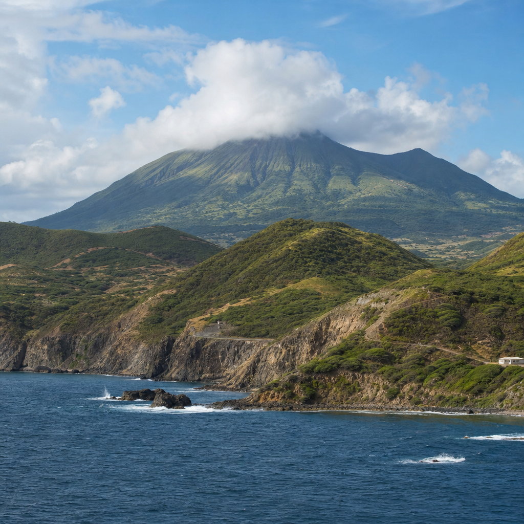
Mount Liamuiga is the island’s most prominent volcanic feature and the key to its physical geography. Formerly called Mount Misery, it is a stratovolcano whose summit crater and upper slopes dominate northern Saint Kitts. The mountain’s elevation creates strong orographic effects: moist trade winds rise, cool, and condense into frequent cloud and rainfall, supporting lush montane vegetation. This is one reason the upper interior feels dramatically different from the drier coast even over short distances.
The summit crater is one of the island’s defining landforms. It is not simply a scenic depression but evidence of the volcano’s eruptive history and subsequent collapse or explosive excavation. Crater walls, dense vegetation, and mist often obscure the full shape, yet the landform remains crucial for interpreting the island. The crater area stores water, channels runoff, and creates microhabitats shaped by elevation, wind exposure, and persistent humidity. Hikers experience this geography directly as trails pass through bands of former farmland, secondary forest, and rainforest before reaching cloud forest near the top.
Beyond Liamuiga, the central highlands include the Verchilds range and Olivees mountain area, which together form an axial spine. These uplands divide watersheds and create a radial drainage pattern that sends short, steep watercourses toward the sea. On maps and on the ground, the geography explains why roads often wrap around the island rather than cross it directly. The interior is topographically complex, deeply incised, and in many places still difficult terrain despite the island’s modest size.
Volcanic landforms, soils, and drainage
Saint Kitts displays several classic volcanic landforms in compressed scale: cratered peaks, lava-derived ridges, ash mantles, boulder-strewn ghauts, and coastal aprons built from eroded volcanic sediment. A ghaut, a term widely used in the eastern Caribbean, is a steep-sided ravine or seasonal stream channel. On Saint Kitts, ghauts are fundamental geographic features because intense rainstorms rapidly move water downslope through narrow valleys. Even where streams do not flow year-round, the channels reveal the island’s erosional energy.
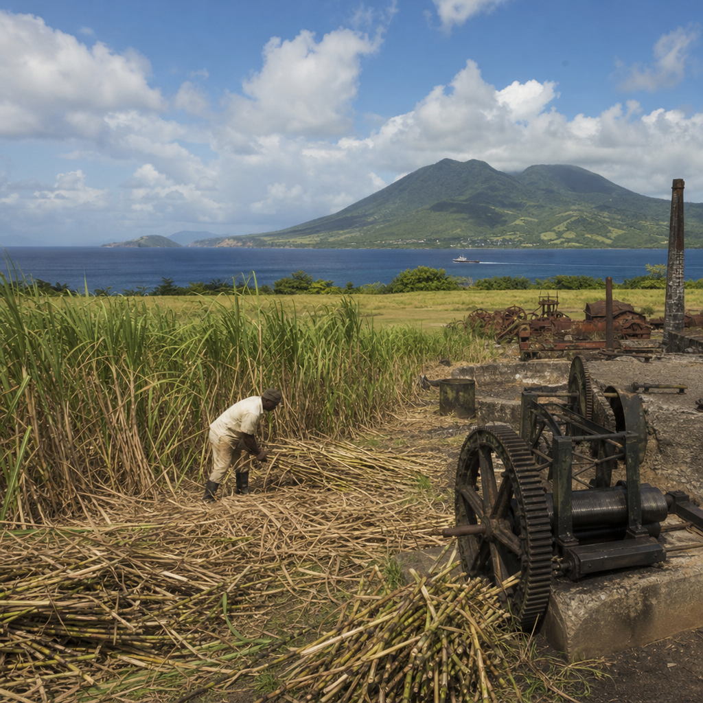
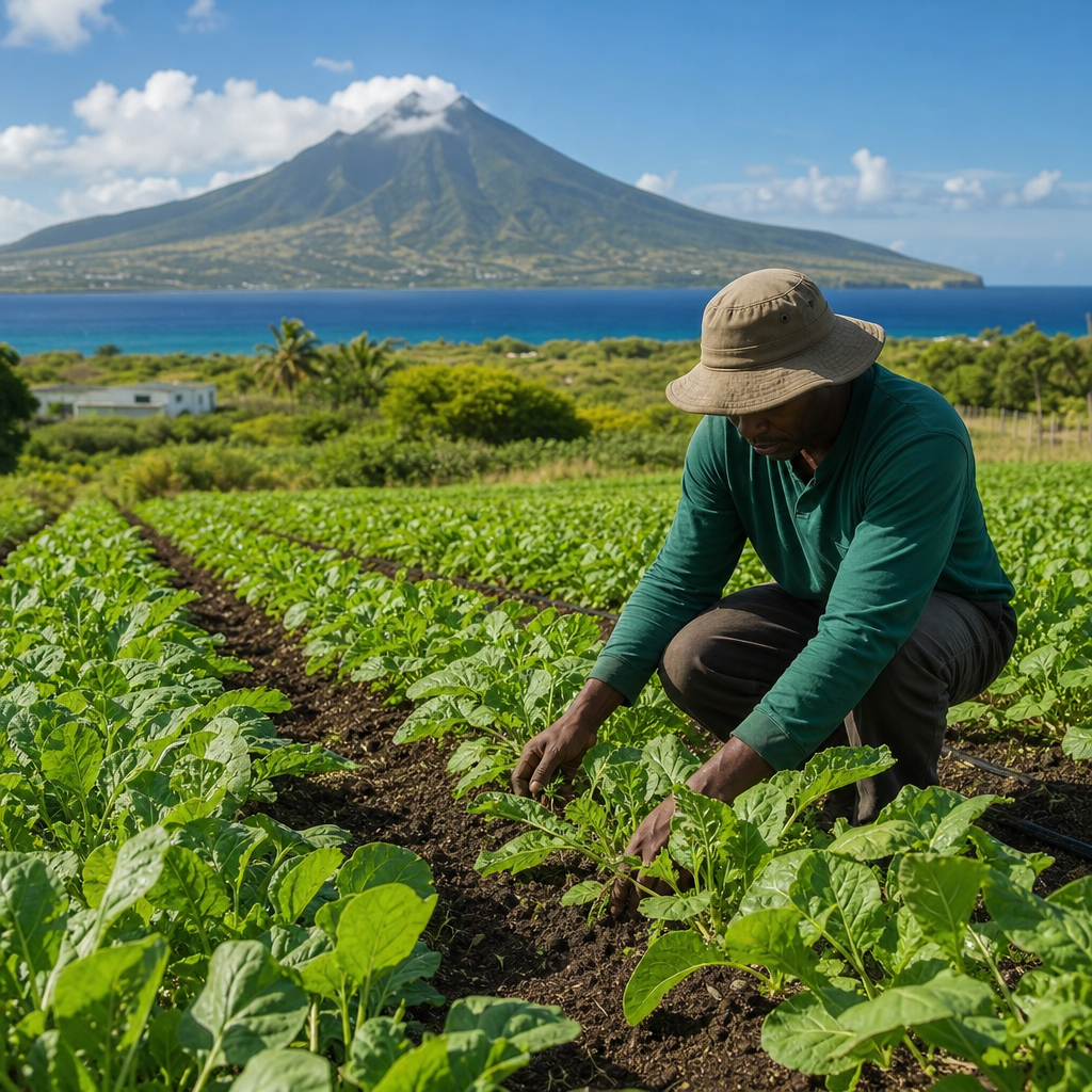
Volcanic soils on Saint Kitts are generally fertile because weathered ash and lava release mineral nutrients, though fertility varies with slope, drainage, and erosion. Historically, these soils supported the sugar industry that transformed much of the lower landscape into plantations. Today they sustain small-scale farming, fruit trees, root crops, and dense natural vegetation where cultivation has retreated. The same soils can also be fragile. On steep slopes, clearing forest cover increases runoff and slope instability, reducing long-term productivity.
The relationship between slope, rainfall, and soil depth creates distinct land-use zones. Lower coastal plains and gentler foothills were easiest to cultivate and settle, while the wetter interior remained more heavily forested. This pattern appears repeatedly across volcanic islands, but on Saint Kitts it is especially legible because the island is compact and the elevational transitions are so abrupt. In a single day, you can move from salt-sprayed shore to fertile midslope to cloud-damp forest and see how volcanic geography controls each setting.
| Feature | How it formed | Why it matters today |
|---|---|---|
| Mount Liamuiga crater | Explosive activity and collapse at the summit | Shapes rainfall patterns, habitats, and hiking routes |
| Ghauts | Rapid erosion by storm runoff on steep volcanic slopes | Channel floods, move sediment, and divide local terrain |
| Black and gray sand beaches | Breakdown of volcanic rock and nearshore sediment sorting | Influence coastal ecology, tourism, and beach character |
| Fertile volcanic soils | Weathering of ash, tuff, and lava over time | Support farming, forest regrowth, and diverse plant life |
Coastlines, beaches, and the land-sea connection
One of the most visible expressions of Saint Kitts’ volcanic origin is its coastline. Many beaches contain dark sand derived from eroded volcanic minerals, though color varies with local sediment sources, shell content, and wave conditions. On Atlantic-facing shores, stronger exposure often produces rougher surf and different sediment textures than on the more sheltered Caribbean side. This contrast is not accidental. It reflects how volcanic topography meets prevailing winds, marine energy, and reef development.
Volcanic islands rarely end at the waterline in a simple way. On Saint Kitts, sediments from upland erosion feed coastal systems, while headlands and bays often correspond to harder or softer rock units. Where streams or ghauts reach the coast, they can deliver pulses of sand, silt, and organic matter after storms. Nearshore habitats, including seagrass beds and reefs, therefore depend partly on what happens upslope. Excess sediment from poorly managed land can reduce water clarity and stress corals, while stable, vegetated watersheds help protect marine ecosystems.
The southeast peninsula provides another useful example. This area includes older volcanic hills, salt ponds, narrow isthmuses, and striking coastal relief that differs from the wetter central mountains. It demonstrates that Saint Kitts’ volcanic geography is not uniform. Age, exposure, and erosion have created a mosaic of landforms, each with distinct wildlife value. Shorebirds use pond margins, dry forest occupies lower slopes, and marine habitats develop according to shelter, substrate, and runoff patterns from the adjacent land.
Rainforest, wildlife, and elevation zones
Because volcanic mountains force air upward, they create predictable ecological zones. On Saint Kitts, lower elevations once held extensive dry to moist forest, much of which was later cleared for agriculture. As elevation increases, rainfall rises and temperatures drop, supporting secondary woodland, rainforest, and cloud-affected summit vegetation. This vertical layering is one of the clearest links between geology and wildlife. The volcano built the elevation; the elevation structures the habitat.
In field conditions, the change is immediate. Lower slopes may feature acacia, grasses, and disturbed habitats near roads or former estates. Mid-elevations support taller broadleaf forest with vines, ferns, and moisture-loving understory plants. Higher on Liamuiga, cloud interception sustains mosses, tree ferns, and dense canopy growth. These habitats support birds such as the purple-throated carib and other Lesser Antillean species, as well as monkeys, bats, reptiles, and countless invertebrates adapted to humid tropical terrain.
Volcanic geography also influences freshwater availability for wildlife. Although Saint Kitts is not known for large rivers, its steep catchments collect rainfall efficiently. Springs, wet gullies, and shaded ravines create refuges during drier periods. In conservation planning, these microhabitats matter as much as the headline summit because they maintain connectivity across the landscape. For a Nature and Wildlife hub, this is the key point: geology is not background scenery. It is the framework that determines where species can feed, breed, shelter, and move.
Hazards, conservation, and responsible exploration
Saint Kitts’ volcanoes are not just relics; they are part of an active arc, even if no historic eruption has defined modern life on the island in the way it has on nearby Montserrat. The main practical hazards are steep terrain, rockfall, flash flooding in ghauts, coastal erosion, and landslides after intense rain. Regional monitoring by institutions such as the University of the West Indies Seismic Research Centre is important because volcanic islands require long-term observation even during quiet periods.
Conservation and tourism both benefit from reading the landscape accurately. Trail development on Mount Liamuiga must account for soil compaction, root exposure, and storm damage. Coastal construction should consider sediment movement and the vulnerability of narrow beach systems. Watershed protection in the highlands helps downstream reefs as well as farms and communities. I have seen that the most successful island interpretation programs connect these dots for visitors: the rainforest hike, the black sand beach, and the offshore snorkeling site are parts of one volcanic system.
For travelers and educators, responsible exploration starts with good local guides, proper footwear, and respect for weather conditions. It also means noticing the details that reveal geologic history: angular boulders in a ghaut, layered ash-rich soils on a cut bank, the shift from dry scrub to wet forest over a short climb, and the way bays align with ridges and headlands. These observations turn Saint Kitts from a scenic destination into an intelligible landscape, and that deeper understanding is what makes the island memorable.
Saint Kitts’ volcanic features make the island far more than a beach destination. They explain the shape of the mountains, the pattern of forests, the fertility of the soils, the character of the beaches, and the distribution of wildlife habitats from coast to cloud forest. Mount Liamuiga anchors this geography, but the full story includes older volcanic centers, eroded ghauts, sediment-fed shores, and the constant interaction between rain, rock, and sea. When viewed together, these features show how a small island can hold exceptional geologic complexity.
For anyone exploring Nature and Wildlife on Saint Kitts, volcanic geography is the hub that connects every related topic. It clarifies why certain birds occur at particular elevations, why reefs depend on upland watershed health, why hikers encounter rapid habitat changes, and why land use has historically clustered in some areas and not others. It also provides a practical lens for reading conservation challenges, from erosion control to habitat protection. The island’s natural systems are easiest to understand when you begin with the volcano-built terrain beneath them.
If you want to appreciate Saint Kitts more fully, use its volcanic landscape as your guide. Walk a mountain trail, visit contrasting coasts, ask about local geology, and explore related topics such as rainforest ecology, coastal habitats, and watershed conservation. The more closely you look, the clearer it becomes that Saint Kitts’ most distinctive natural feature is not one mountain alone, but an entire living island shaped by volcanic forces.
Frequently Asked Questions
What makes Saint Kitts’ volcanic geography unique compared with other Caribbean islands?
Saint Kitts stands out because its volcanic geography is expressed across the entire island rather than in just one dramatic peak or crater. Although it is relatively small, the island contains a remarkably complete volcanic landscape: central mountains, radiating ridges, deeply cut ghauts, dark sand and mixed-sediment beaches, fertile agricultural soils, and moist upland forests shaped by elevation and rainfall. In other words, Saint Kitts functions like an interconnected volcanic system where landforms, drainage, ecology, and human land use are all tied to its eruptive past.
The island was built through repeated episodes of volcanic activity over long spans of geological time. Those eruptions produced layers of lava, ash, and other fragmented volcanic material, while later collapse events and erosion reshaped the original volcanic forms. Tropical weathering then softened, deepened, and redistributed these materials. Heavy rainfall carved gullies and steep valleys, while vegetation stabilized some slopes and accelerated soil development in others. The result is a landscape that reveals not only how volcanoes build islands, but also how climate and time transform volcanic terrain into a living, habitable environment.
How did volcanic activity create the mountains and steep terrain seen on Saint Kitts today?
The mountainous interior of Saint Kitts is the direct result of volcanic construction. Like many islands in the Lesser Antilles, Saint Kitts formed in an island arc setting where one tectonic plate is forced beneath another, generating magma that rises toward the surface. Over repeated eruptive cycles, that magma created volcanic centers made up of lava flows, ash deposits, and other erupted materials. These accumulated into elevated landforms, eventually producing the rugged mountainous backbone that defines the island’s interior.
However, the island’s topography was not shaped by eruption alone. Once the main volcanic masses were built, they were modified by gravitational collapse, landslides, stream erosion, and tropical weathering. Volcanic rocks and ash can be highly variable in strength, so some slopes remained steep while others broke down more quickly. Rainwater concentrated in natural drainage lines, cutting narrow, sharply defined channels that became ghauts. Over time, these processes turned broad volcanic uplands into a more dissected terrain of peaks, ridges, valleys, and steep-sided ravines. That is why Saint Kitts’ landscape feels so dramatic: it combines the constructional force of volcanism with the relentless sculpting power of water and weather.
Why are Saint Kitts’ beaches often black, gray, or mixed in color?
The color of many beaches on Saint Kitts reflects the island’s volcanic origin. Black and gray sands typically form from the breakdown of dark volcanic rocks rich in minerals such as basaltic components, pyroxenes, and magnetite-bearing material. When volcanic rocks erode under the action of rain, waves, and stream transport, they shed mineral grains and rock fragments that accumulate along the shoreline. Depending on local currents, sediment supply, and the amount of coral or shell material mixed in, beaches may appear jet black, dark gray, brownish, or visibly blended with lighter sands.
These beach colors also reveal the island’s geography as a linked system. Material eroded from inland volcanic slopes can be carried downslope through ghauts and coastal streams, eventually reaching the sea. Once there, waves and currents sort and redeposit the sediments along different stretches of coast. A beach’s exact appearance therefore depends on both geology and coastal dynamics. On Saint Kitts, beach color is not just a scenic detail; it is visible evidence that the mountains, valleys, rainfall patterns, and shoreline are all part of the same volcanic story.
What are ghauts, and why are they so important to understanding Saint Kitts’ landscape?
Ghauts are steep-sided gullies, ravines, or watercourses that channel runoff from the island’s higher elevations down toward the coast. On Saint Kitts, they are especially important because they show how volcanic topography interacts with tropical rainfall. Volcanic islands often begin with elevated, uneven surfaces made of lava and loose pyroclastic material. In a wet tropical climate, rainwater quickly exploits fractures, weak zones, and natural depressions, carving them into deeper channels over time. The result is a network of ghauts that can appear dry during some periods but become powerful conduits during heavy rain.
These features matter for several reasons. Geologically, they expose how erosion dissects volcanic terrain and transports sediment from mountains to lowlands and beaches. Ecologically, ghauts can support distinct plant communities because they concentrate moisture and create sheltered microenvironments. Practically, they affect infrastructure, drainage planning, agriculture, and hazard awareness, especially during intense storms when runoff can become sudden and forceful. In short, ghauts are one of the clearest examples of how Saint Kitts’ volcanic foundation continues to shape daily environmental processes long after the eruptions that formed the island have ended.
How do volcanic soils and cloud forests fit into the geography of Saint Kitts?
Volcanic soils are one of the most important long-term outcomes of Saint Kitts’ eruptive history. As lava, ash, and other volcanic deposits break down in the warm, wet tropical climate, they can produce mineral-rich soils that are often highly fertile. This helps explain why volcanic islands frequently support dense vegetation and, historically, productive agriculture. On Saint Kitts, the relationship between geology and soil is especially visible because elevation, slope, rainfall, and rock type all influence how deeply weathering occurs and where fertile material accumulates.
The cloud-wrapped forests of the uplands are another key part of this system. Higher elevations force moist air upward, where it cools and condenses, creating frequent cloud cover and elevated humidity. That moisture supports lush vegetation, which in turn affects erosion, soil retention, and water cycling. Forest roots stabilize steep volcanic slopes, organic matter enriches the ground, and persistent moisture accelerates weathering of volcanic rock into soil. This creates a feedback loop in which geology helps create the ecological conditions for forest growth, and the forest then helps preserve and reshape the volcanic landscape. Understanding Saint Kitts fully means seeing its volcanoes not as isolated landforms from the past, but as the geological foundation for the island’s modern soils, hydrology, and biodiversity.