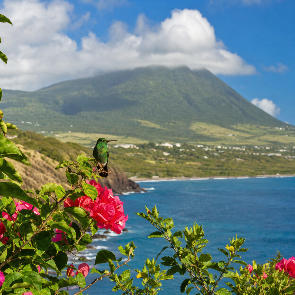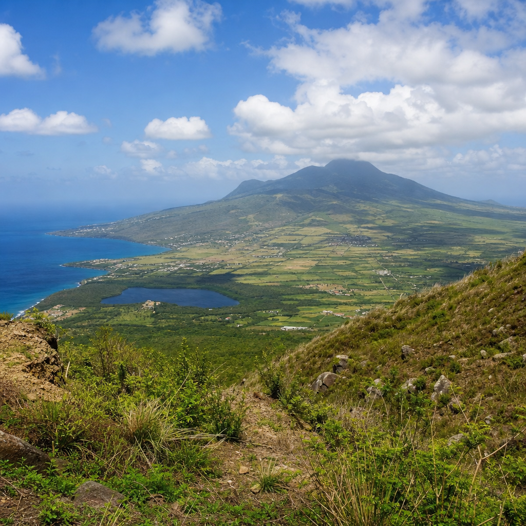
Saint Kitts rises from the eastern Caribbean as a compact volcanic island where steep green peaks, black-sand coves, mineral-rich soils, and rain-fed valleys reveal the force that built it. Exploring the volcanic landscapes of Saint Kitts means understanding more than scenery. It means reading the island’s geology, ecology, agriculture, and settlement patterns as parts of one connected system shaped by repeated eruptions, erosion, and tropical weather. In my work covering Caribbean nature destinations, Saint Kitts consistently stands out because its volcanic terrain is unusually accessible: within a short drive, visitors can move from coastal lava-derived beaches to cloud-wrapped forest on Mount Liamuiga, then descend through old sugar estates rooted in fertile ash-rich ground.
The term volcanic landscape refers to landforms created directly or indirectly by volcanic activity. On Saint Kitts, that includes the central mountain chain, crater features, steep ghauts that channel rainwater, cliffs made of consolidated volcanic deposits, and broad slopes built from layers of lava, ash, and fragmented rock. The island is part of the Lesser Antilles volcanic arc, formed where the Atlantic plate subducts beneath the Caribbean plate. That tectonic setting explains why the island is mountainous rather than flat, why its soils support dense vegetation, and why geothermal features and earthquake awareness remain relevant even though there is no present-day eruption.
This matters for travelers, naturalists, planners, and local businesses alike. Volcanic geology influences hiking routes, bird habitats, freshwater flow, farming conditions, road construction, and coastal sediment. It also shapes the identity of Saint Kitts as a Nature and Wildlife destination. Many travelers arrive for beaches and leave talking about the island’s interior: giant tree ferns in the rainforest, vervet monkeys crossing estate roads, panoramic crater-rim views, and the contrast between dry lowlands and misty uplands. As a hub for miscellaneous coverage within this subtopic, this guide connects the main themes you need to understand the island fully, while pointing toward deeper exploration of trails, habitats, beaches, and conservation topics across related pages.
How volcanic forces built Saint Kitts
Saint Kitts was formed by a long sequence of volcanic events that created a ridge of mountains running roughly north to south. The island’s highest point, Mount Liamuiga, reaches about 1,156 meters, making it the dominant landform and the clearest starting point for understanding the island. Liamuiga is a stratovolcano, meaning it was built over time by alternating layers of lava, ash, and other volcanic material. Like many stratovolcanoes in island arcs, it produced steep slopes and a summit crater rather than a broad shield profile. The mountain’s former name, Mount Misery, appears in older maps and guide narratives, but Liamuiga, a Kalinago-derived name often translated as “fertile island,” better reflects the ecological richness produced by its geology.
Several volcanic centers helped shape the island beyond Liamuiga alone. The central mountain range includes peaks such as Verchilds Mountain and Olivees Mountain, while the rugged southeast peninsula shows older volcanic structures cut by erosion and bordered by marine processes. Over geologic time, eruptions deposited pyroclastic materials and lava flows, then heavy rainfall carved those deposits into valleys, ridges, and ghauts. A ghaut is a steep-sided seasonal watercourse common across volcanic Caribbean islands. On Saint Kitts, ghauts are not minor features. They direct runoff, influence road placement, and create linear habitat corridors from uplands to the sea.
One reason Saint Kitts feels so dramatic in a relatively small area is relief. Elevation changes quickly. That means short horizontal distances can produce major shifts in temperature, moisture, and vegetation. It also means landscapes are layered: coastal platforms give way to foothills, foothills rise into dense tropical forest, and upper slopes often sit in cloud and mist. For visitors, this translates into varied experiences without long travel times. For scientists and conservation managers, it creates compact but valuable ecological gradients.
Mount Liamuiga, crater terrain, and rainforest ecology
Mount Liamuiga is the signature volcanic experience on Saint Kitts and one of the most rewarding hikes in the eastern Caribbean. The ascent usually begins through former agricultural land before entering wetter forest belts. As elevation increases, vegetation shifts from secondary growth to mature rainforest, with buttressed trees, lianas, mosses, epiphytes, and tree ferns becoming more prominent. Near the summit, hikers reach the crater rim, where views can extend across Saint Kitts, neighboring Sint Eustatius, and, in clear weather, St. Barts, Saba, and Saint Martin. Inside the crater, dense vegetation now fills much of the depression, showing how tropical ecological succession reclaims volcanic landforms.
The mountain is also a practical lesson in how volcanoes support biodiversity. Volcanic soils are often young in geologic terms yet agriculturally and biologically productive because weathered ash and rock release minerals. High rainfall on upper slopes feeds streams and groundwater recharge, while the mountain’s elevational zones create habitat diversity. Birds frequently reported in forested areas include Caribbean elaenia, purple-throated carib, green-throated carib, and various migrant warblers depending on season. Vervet monkeys, introduced during the colonial period, are now a familiar presence, though their ecological impact is mixed because nonnative mammals can alter crop systems and native habitat use.
Trail conditions on Liamuiga also reveal the realities of volcanic terrain. Routes can be muddy, root-tangled, and slippery because ash-derived soils and tropical rain combine to create soft surfaces. In my experience, the difference between a comfortable climb and a difficult one is often not fitness alone but timing, footwear, and guide quality. Local guides understand microclimates, safe turnaround points, and how quickly clouds can reduce visibility on steep ground. That local knowledge matters as much as any map.
Coasts, black sand, and the southeast peninsula
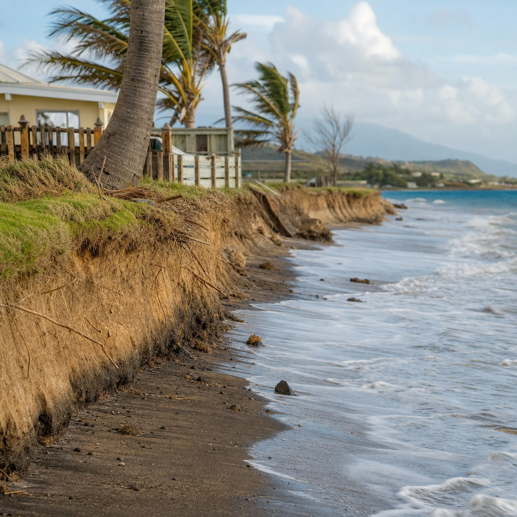
Volcanic islands are often judged by their peaks, but Saint Kitts’s coast tells the same geologic story at eye level. Darker sands on some beaches come from eroded volcanic minerals, while bouldered coves and rocky points show how lava-derived material interacts with wave energy. Not every beach on Saint Kitts is jet black; many are brown, gray, or mixed in tone because volcanic sediment blends with coral fragments and shell material. This variation is useful for travelers who expect a single beach type and miss the geological nuance. The island’s coastline reflects both volcanic origin and constant marine reworking.
The southeast peninsula is especially important because it presents older, drier, wind-exposed volcanic landscapes that contrast with the wetter central mountains. Here, low hills, salt ponds, scrub vegetation, and dramatic overlooks create a different expression of the island’s volcanic character. The isthmus toward Timothy Hill offers one of the island’s classic views, with the Atlantic on one side and the Caribbean on the other. That narrow connection emphasizes how volcanic construction and later erosion assembled an island of linked terrains rather than one uniform mass.
| Area | Main volcanic feature | What visitors notice first | Why it matters |
|---|---|---|---|
| Mount Liamuiga | Stratovolcano and crater | Steep rainforest hike and summit views | Best single site for understanding elevation, ecology, and geology |
| Central Range | Eroded volcanic ridges | Deep ghauts, dense forest, cooler air | Shows how rainfall reshapes volcanic deposits |
| Southeast Peninsula | Older volcanic hills and coastal outcrops | Open views, scrub, salt ponds | Contrasts dry coastal terrain with wet uplands |
| Western and northern coasts | Volcanic sand and rock-derived beaches | Dark sand, cobbles, dramatic surf lines | Links inland erosion to shoreline character |
For photographers and general visitors, this coastal diversity is one of Saint Kitts’s biggest strengths. You can pair a rainforest hike with an afternoon at a volcanic beach and understand the island more completely than by treating mountain and coast as separate attractions. They are connected by the constant breakdown and movement of volcanic material.
Fertile soils, agriculture, and historic estates
Saint Kitts’s volcanic landscapes are not only scenic; they are economically and historically foundational. The island’s fertile soils supported centuries of sugar cultivation, and many estate roads still trace the contours dictated by slope stability, drainage, and access to workable land. Although the sugar industry officially ended in 2005, its spatial imprint remains visible in cane-field remnants, stone structures, windbreak trees, and rail alignments now repurposed in part by the St. Kitts Scenic Railway. That railway gives passengers a practical view of how agriculture developed on relatively flatter coastal belts below the steep volcanic interior.
Volcanic soils often have strong agricultural potential, but they are not effortless to farm. Productivity depends on slope, rainfall, erosion control, and land management. On Saint Kitts, lower and mid-elevation areas have supported crops such as sugarcane, vegetables, and fruit, while household gardens benefit from mineral-rich ground. However, intense tropical rain can strip exposed soil from steep areas quickly. That is why vegetation cover, terracing where appropriate, and drainage planning are so important. The same land that looks lush can degrade if overcleared.
Historic estates also help modern visitors read the landscape. Many great houses and plantation complexes were built where volcanic topography allowed transport access, wind exposure, and oversight of surrounding fields. Brimstone Hill Fortress, while principally military and often discussed under heritage tourism, also occupies a commanding volcanic promontory that demonstrates how geology influenced defense and visibility. Across the island, human settlement adapted to volcanic contours rather than ignoring them. That long interaction between terrain and land use is central to any serious understanding of Saint Kitts.
Wildlife, water, and conservation on a volcanic island
Volcanic topography supports Saint Kitts’s wildlife by creating habitat mosaics. Moist forest in the uplands differs sharply from coastal scrub, mangrove-edge zones, offshore reef environments, and seasonal pond systems. Elevation and exposure govern moisture, which in turn shapes plant communities and animal distribution. In practical terms, that means birdwatchers, hikers, and marine visitors can all encounter different dimensions of the same island within one itinerary. The island’s nature value lies in these linked systems rather than any single flagship species.
Water is one of the most important but least appreciated volcanic landscape benefits. Forested volcanic mountains capture rainfall, slow runoff, and feed aquifers and streams. When upper watersheds remain healthy, downstream communities gain cleaner water, reduced flash-flood intensity, and better slope stability. When they are disturbed by unchecked clearing, road cuts, or invasive plants, the effects can cascade quickly. Sediment reaches reefs, ghauts erode more aggressively, and infrastructure becomes harder to maintain. This is why conservation on Saint Kitts is not just about protecting beautiful forest for hikers. It is directly tied to public safety, agriculture, and tourism quality.
Current conservation concerns include habitat fragmentation, invasive species, storm damage, and development pressure along coasts and scenic corridors. Responsible visitation helps. Staying on trails reduces erosion, using certified guides supports local stewardship, and choosing operators that follow reef-safe and wildlife-respectful practices reduces cumulative impact. The best nature travel on Saint Kitts is low-drama and observant: walk carefully, ask questions, notice the soil underfoot, and treat the island as a living volcanic system rather than a backdrop.
How to explore Saint Kitts’s volcanic landscapes well
The best way to explore the volcanic landscapes of Saint Kitts is to combine perspective levels. Start with an overview from Timothy Hill or another panoramic coastal viewpoint to see how mountain ridges dominate the island. Follow with a guided rainforest or Mount Liamuiga hike to experience the interior directly. Add a stop at a darker-sand beach or rocky coastal site to connect summit geology with shoreline sediment. If time allows, include a heritage property or scenic railway segment to understand how volcanic land shaped settlement and agriculture. This sequence turns isolated attractions into a coherent story.
Preparation matters. Wear trail shoes with grip, carry more water than you think you need in lower elevations, and expect conditions to change with altitude. On steep wet trails, a walking stick can help on descent. For independent travelers, local guide services, the St. Christopher National Trust, and official tourism channels are useful starting points for current access information and conservation context. Cruise visitors with limited time should not overpromise themselves a summit hike and a full beach day; Saint Kitts rewards focused exploration more than rushed checklists.
As a hub within Nature and Wildlife coverage, this article should lead you toward deeper reading on Saint Kitts rainforest trails, volcanic beaches, birdwatching sites, coastal ecology, and responsible outdoor planning. The key takeaway is simple: the island’s volcanoes are not a single attraction. They are the reason the whole landscape looks, grows, drains, and lives the way it does. Explore with that framework in mind, and Saint Kitts becomes far richer than a postcard destination. Plan one geology-informed day outdoors on your next visit, and you will see the island with sharper eyes.
Frequently Asked Questions
What makes Saint Kitts a volcanic island, and how does that shape what visitors see today?
Saint Kitts is volcanic because the island was built by repeated eruptions over long geological periods, creating a landscape of steep central mountains, ridgelines, deep valleys, and dramatic coastal contrasts. The island’s interior is dominated by Mount Liamuiga, a stratovolcano whose form immediately signals its volcanic origin. Over time, lava, ash, and other eruptive materials accumulated, then weathered under tropical rainfall into the fertile, mineral-rich soils that now support dense vegetation and agriculture. For visitors, that volcanic history is visible almost everywhere: in the abrupt rise from shoreline to highland, in the dark sands and rocky coastal sections, in the lush slopes where moisture gathers, and in the cratered high-country terrain. Even the island’s settlement and farming patterns reflect this origin, with people historically using gentler coastal plains and productive volcanic soils while the steeper interior remained heavily forested. In other words, the scenery is not just beautiful; it is a direct expression of the island’s volcanic foundation and the long interaction between eruption, erosion, and tropical climate.
How does Mount Liamuiga help explain the volcanic landscapes of Saint Kitts?
Mount Liamuiga is the clearest key to understanding Saint Kitts because it is both the island’s highest peak and its most prominent volcanic feature. As a stratovolcano, it represents the type of layered volcanic building that created much of the island’s rugged topography. Its crater, upper slopes, and radiating valleys show how volcanic construction and later erosion worked together to shape the land. Rainfall on the mountain feeds streams and moist forest systems, which means Mount Liamuiga is not only a geological landmark but also an ecological engine for the island. As elevation increases, vegetation changes, temperatures drop, and cloud moisture becomes more important, creating a series of environmental zones tied directly to the mountain’s volcanic mass. For hikers and nature travelers, this means that climbing Liamuiga is not simply a scenic outing; it is a journey through the island’s geological story, from cultivated lower lands through rainforest and into the crater environment. The mountain also helps explain why Saint Kitts feels so vertically dramatic despite its compact size. Much of the island’s identity, from watershed patterns to habitat diversity, is connected to this volcanic core.
Why are Saint Kitts’ soils, forests, and farms so closely linked to its volcanic past?
Volcanic islands often develop highly productive soils as volcanic rock and ash break down into mineral-rich earth, and Saint Kitts is an excellent example of that process. The island’s soils have supported generations of cultivation because they retain nutrients and, in many areas, respond well to tropical rainfall. That agricultural potential helped shape historical land use, especially in lower and mid-elevation zones where terrain was more manageable. At the same time, the steepness of the volcanic interior protected large areas of forest, allowing rain-fed ecosystems to thrive in the mountains and valleys. This creates a powerful connection between geology and ecology: the same eruptions that built the island also laid the groundwork for fertile farmland, thick vegetation, and diverse habitats. Forest cover on volcanic slopes plays a practical role as well, helping stabilize soil, regulate water flow, and reduce erosion during heavy rains. In a place like Saint Kitts, you cannot separate farming, watershed health, and biodiversity from geology. The volcanic past is still active in a landscape sense, not through ongoing eruptions, but through the soils people cultivate, the forests that trap moisture, and the valleys that channel water toward the coast.
Are the black-sand coves and rugged coastlines on Saint Kitts connected to volcanic activity?
Yes, many of the darker sands, rocky shorelines, and rugged coastal textures around Saint Kitts are closely tied to the island’s volcanic origin. Black or dark sand typically forms when volcanic materials such as basaltic fragments, ash-derived particles, and other dark minerals are broken down by weathering and wave action. On Saint Kitts, coastal appearance also depends on how local rock has eroded, how streams deliver sediment from upland volcanic slopes, and how currents redistribute that material along the shore. This means the coast is not separate from the interior; it is part of the same geological system. Valleys carved into volcanic highlands send sediment downslope, while waves sort and reshape what arrives at the water’s edge. That is why some coves feel dramatically different from one another, with variations in sand color, grain size, and shoreline form. For travelers, these beaches and coastal outcrops offer some of the most accessible evidence of the island’s volcanic character. They reveal that Saint Kitts was not only built upward by eruptions but is also continually being reshaped outward by erosion, runoff, and the sea.
What is the best way to explore Saint Kitts’ volcanic landscapes responsibly and understand them more deeply?
The best approach is to treat the island as an interconnected natural system rather than a checklist of scenic stops. Start by exploring across different elevations and landforms: coastal areas, cultivated foothills, rainforest trails, and, if conditions and guidance allow, the Mount Liamuiga region. This gives you a clearer sense of how volcanic structure influences drainage, vegetation, and settlement. Hiking with knowledgeable local guides is especially valuable because they can connect what you are seeing on the ground to the island’s geology, history, and ecology in a way that interpretive signs alone often cannot. Responsible exploration also means staying on established trails, avoiding disturbance to fragile vegetation, respecting private agricultural land, and being mindful of how quickly tropical conditions can change in mountain environments. Good footwear, rain protection, and adequate water are essential because volcanic terrain can be steep, muddy, and uneven. To understand the island more deeply, pay attention to patterns: where soils appear richest, where valleys collect moisture, where settlements occupy flatter ground, and where coastlines show dark sand or exposed rock. On Saint Kitts, the most rewarding experience comes from seeing that the island’s beauty is not random. Its forests, farms, beaches, and mountain trails all make more sense once you recognize them as expressions of a volcanic landscape shaped over time by eruption, rainfall, weathering, and human use.