Nevis’ natural fountains are among the island’s most overlooked treasures, supplying clear freshwater from underground aquifers, volcanic slopes, and shaded mountain catchments that have sustained settlements, farms, and wildlife for generations. On a small Caribbean island better known for beaches and historic estates, freshwater springs reveal a different landscape story: one shaped by rainfall moving through porous rock, cloud forest soils storing moisture, and gravity carrying it downhill into public standpipes, ravines, gardens, and coastal communities. In practical terms, a freshwater spring is a place where groundwater naturally emerges at the surface, often because impermeable layers force stored water outward along a slope or fracture. On Nevis, these springs matter because freshwater is never guaranteed on small islands. Rainfall can be seasonal, drought can strain supplies, and development can increase pressure on limited resources. I have walked several of Nevis’ inland routes after heavy rain and during drier months, and the contrast is instructive: a roadside seep that looks minor in April may become a crucial local water source by late summer. Understanding the island’s springs helps visitors appreciate Nevis beyond resort zones, and it helps residents, planners, and nature-focused travelers see how geology, ecology, and heritage connect across the island.
What makes Nevis’ freshwater springs possible
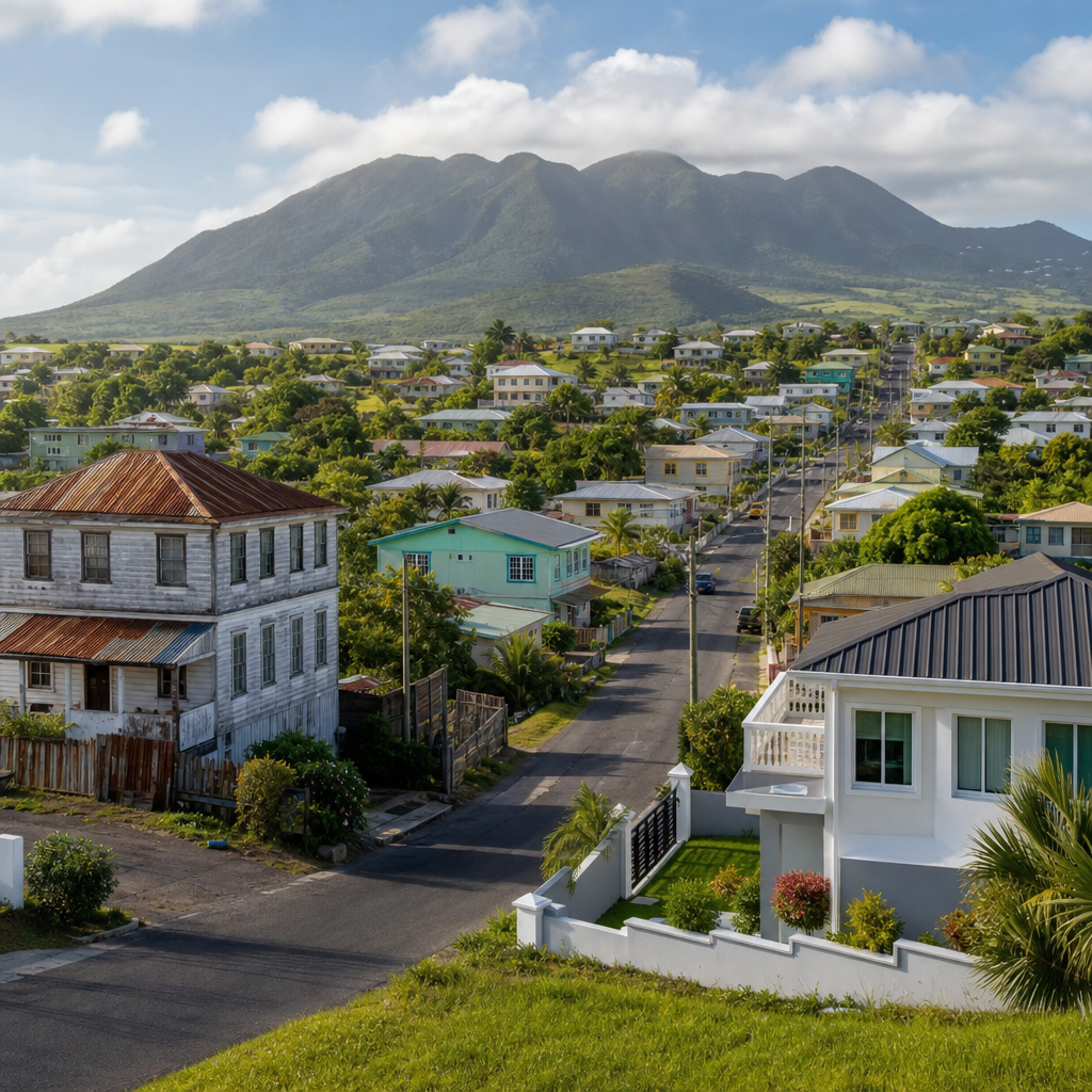
Nevis is a volcanic island dominated by Nevis Peak, rising roughly 985 meters above sea level. That topography is the starting point for understanding why freshwater springs appear where they do. Moist trade winds push rain-bearing clouds into the mountain, where higher elevations receive more precipitation than the coast. Some of that rainfall runs off quickly into ghauts, the steep seasonal channels common across the Eastern Caribbean. A significant share, however, infiltrates the ground. Volcanic soils, weathered ash, fractured bedrock, and vegetated uplands allow water to soak in, move slowly downslope, and collect above less permeable layers. When those stored waters intersect the surface, springs form.
This process is simple in concept but highly variable in the field. Spring flow can depend on slope angle, rock fractures, recent rainfall, land cover, and human withdrawals from wells or distribution systems. In many Caribbean islands, including volcanic islands like Dominica, St. Lucia, and Nevis, spring systems are strongly linked to montane catchments. Forest cover is especially important because it reduces erosion, improves infiltration, and limits rapid runoff. On Nevis, where the central peak still supports wetter and more biodiverse habitats than the coast, these natural conditions help create pockets of reliable freshwater. The result is not a single famous spring complex, but a network of small natural outlets, seeps, stream-fed points, and community water sites spread across the island’s interior and lower slopes.
For searchers asking whether Nevis has rivers, the short answer is not in the large, permanent sense seen on continental landmasses. Instead, the island has ghauts, seasonal streams, wet ravines, and spring-fed flows. That distinction matters. Springs on Nevis are part of a water system that is localized and sensitive rather than abundant and uniform. If you want to explore them, think in terms of catchments and slopes, not broad river valleys.
Where to find springs and spring-fed landscapes on Nevis
Freshwater springs on Nevis are best understood by region rather than by a single checklist of famous landmarks. The island’s greener interior, especially the areas rising toward Nevis Peak, holds the strongest spring potential. Villages and roadways on the mountain’s lower flanks often sit near old water routes because earlier settlement patterns followed dependable freshwater access. In places such as Gingerland and neighboring upland districts, you can see how road cuts, retaining walls, and vegetated embankments reveal seepage zones after rain. These may not be dramatic tourist attractions, but they are real expressions of the island’s groundwater system.
The Bath area deserves special attention because it is associated with Nevis’ best-known water heritage. While Bath is widely recognized for geothermal hot springs rather than cool freshwater alone, it illustrates how groundwater emerges in multiple forms on the island. The broader lesson for travelers is that Nevis’ underground water movement is visible in both thermal and non-thermal outlets. A visitor interested in “natural fountains” should therefore look beyond one category. Cool spring water in upland communities, warm mineral waters near Bath, and spring-fed wetland patches all belong to the same broader hydrological story.
Spring-fed landscapes also appear indirectly in shaded ghauts, orchard zones, and older estate lands where vegetation stays greener for longer. Tamarind trees, breadfruit, bamboo, ferns, and moisture-loving understory plants often signal persistent water nearby. Bird activity can be another clue. On morning walks, I have found that areas with steady drips, wet rock faces, or small channels often attract more movement from doves, tremblers, and insects than drier roadside stretches. If you are exploring independently, local guidance is invaluable because some water points are on private land or serve practical community use rather than recreation.
| Area type | What you may see | Why it matters |
|---|---|---|
| Upland village edges | Roadside seepage, standpipes, wet embankments | Shows groundwater emerging near settled areas |
| Mountain foothill trails | Spring-fed trickles, mossy rocks, fern-lined channels | Highlights the link between forest cover and freshwater recharge |
| Bath district | Thermal water features and associated groundwater outlets | Demonstrates Nevis’ diverse underground water systems |
| Estate and garden zones | Greener vegetation, old waterworks, irrigation traces | Connects springs to agriculture and colonial-era land use |
Why springs shaped settlement, farming, and daily life
Freshwater access has always influenced how people live on small islands. On Nevis, springs and dependable catchments helped determine where homes, provision grounds, livestock areas, and roads developed. Before modern island-wide infrastructure, communities depended on localized water collection from springs, wells, cisterns, and rainwater storage. That pattern is familiar across the Caribbean, where topography and rainfall create uneven water access from one district to another. On Nevis, even today, conversations about resilience quickly turn to the balance between municipal supply, household storage, and natural sources.
Historically, estates needed water for workers, animals, processing, and kitchen gardens. While large-scale sugar production depended heavily on labor and land, water availability still shaped operational viability. Areas with access to dependable freshwater had practical advantages, especially during dry spells. Springs also supported household life in more direct ways: washing, cooking, bathing, and tending fruit trees and small plots. Oral histories across Caribbean islands often include memories of carrying water from standpipes or spring boxes, and Nevis fits that broader regional pattern.
These features are not just historical footnotes. They continue to matter in disaster preparedness and drought planning. A storm may damage pipes, while extended dry weather can lower surface flow and stress centralized systems. Communities that understand nearby natural water points often have better local knowledge for emergencies, even if those sources require treatment before drinking. For nature travelers, this gives spring exploration a deeper purpose. You are not just looking at scenic water; you are seeing infrastructure in its oldest and most place-specific form.
Wildlife, habitats, and ecological value around spring systems
Spring environments create small but meaningful habitat mosaics. Because water emerges consistently or semi-consistently, surrounding soils stay cooler and moister than adjacent ground. That difference supports mosses, liverworts, ferns, sedges, amphibious invertebrates, and shade-tolerant plants. On tropical islands, these microhabitats can be disproportionately important because much of the surrounding landscape may be seasonally dry, heavily grazed, or exposed to wind. A damp ravine only a few meters wide can function as a refuge corridor for insects, reptiles, and birds moving between forest patches.
On Nevis, the most visible ecological signal near a spring is often plant diversity. Fern growth thickens, leaf litter decomposes faster, and vines and broadleaf shrubs remain lush when nearby slopes start to brown. Pollinators and nectar-feeding species also benefit indirectly because moisture helps flowering plants persist. Birdwatchers may notice more activity at dawn around wetter gullies, especially where fruiting trees coincide with water access. While Nevis is not marketed primarily as a freshwater wildlife destination, its spring-fed niches add depth to the island’s biodiversity profile.
These habitats also perform ecosystem services. Spring vegetation stabilizes soil, slows erosion, filters sediments, and improves water quality before it moves farther downslope. When catchments are cleared or compacted, those functions decline quickly. Sediment loads increase, channels cut deeper, and emerging water can become muddier after rain. That is one reason conservation on Nevis cannot focus only on beaches, reefs, or charismatic species. Protecting upland vegetation and small water features is equally important because these systems support the island from ridge to reef.
How to explore Nevis’ natural fountains responsibly
The best way to explore freshwater springs on Nevis is with a combination of curiosity and restraint. Many spring sites are modest in scale. They may appear as a shaded seep behind a retaining wall, a trickle crossing a trail, or a community water point rather than a dramatic cascade. Set expectations accordingly. Wear shoes with grip, especially on muddy mountain roads or mossy stones. Bring water even when seeking water, because natural sources may not be safe to drink untreated. A portable filter can help in backcountry settings, but filtration alone does not address every microbial risk. Standard public-health guidance is clear: untreated surface and spring water should not be assumed potable.
Respect for land ownership is essential. Some of the island’s most interesting spring-fed spots lie near farms, homes, and estate lands. Ask permission before entering private property, do not block access roads, and avoid bathing or washing in water sources used by residents. If you hire a local guide, choose someone who understands both trail conditions and community norms. This not only improves safety but also enriches the experience with stories about historic water use, seasonal changes, and local place names that rarely appear on general tourism maps.
Timing matters as well. Shortly after rainfall, seepage zones are easier to identify, vegetation is vivid, and small channels may be active. During the dry season, however, you gain a better sense of which springs are genuinely persistent. Both conditions are informative. Photographers often prefer soft morning light in Gingerland and other upland areas because moisture catches highlights without the harsh glare common at midday. If your broader itinerary includes hiking Nevis Peak, botanical exploration, or heritage estate visits, spring stops fit naturally into the same inland circuit.
Conservation challenges and the future of Nevis’ freshwater sources
Nevis’ springs face familiar island pressures: land-use change, storm damage, erosion, pollution risk, and climate variability. Intense rainfall can overwhelm slopes, sending debris into channels and damaging spring boxes or intake points. Drought periods reduce recharge and increase dependence on stored water and managed distribution. Development adds impervious surfaces that limit infiltration, while poorly controlled runoff can degrade water quality downslope. Invasive plants may also alter catchment conditions by changing shade, root structure, and evapotranspiration patterns.
There is no single solution, but the priorities are clear. Protect upland forests, manage roads and drainage carefully, monitor water quality, and maintain local knowledge about traditional water points. Caribbean water managers increasingly emphasize integrated watershed management because small islands cannot separate biodiversity protection from water security. On Nevis, that means treating ghauts, forested slopes, spring outlets, and community supply systems as one connected network. It also means supporting practical measures such as rainwater harvesting, leak reduction, and public education about contamination pathways from livestock, septic systems, and solid waste.
For visitors and writers covering Nature and Wildlife, this is where the Miscellaneous category becomes useful. Not every important natural feature fits neatly into birding, beaches, hiking, or marine life. Freshwater springs sit at the intersection of geology, ecology, local history, and resilience planning. They connect inland forests to village life and ultimately to coastal ecosystems affected by sediment and runoff. That makes them ideal hub content: broad enough to introduce many related topics, specific enough to reward close attention, and practical enough to matter beyond sightseeing.
Nevis’ natural fountains show that the island’s most valuable landscapes are not always the loudest or most photographed. Freshwater springs, seepage zones, and spring-fed ravines quietly explain how Nevis works. They reveal the role of Nevis Peak in capturing rain, the importance of forested catchments in storing water, and the ways communities have historically relied on localized sources for survival and stability. They also remind travelers that nature on Nevis is not divided into separate boxes. Geology shapes hydrology, hydrology shapes habitat, and habitat shapes human settlement and everyday life.
If you want to understand Nevis more completely, add freshwater exploration to your Nature and Wildlife plans. Pair coastal sightseeing with an inland drive through greener districts, ask local guides about historic water points, and notice where the landscape stays cool, shaded, and alive. The reward is a more accurate picture of the island: not just a beach destination, but a living volcanic watershed with subtle natural systems worth protecting. Use this hub as your starting point, then continue into related articles on trails, forests, heritage estates, wetlands, and island ecology to see how every part of Nevis connects through water.
Frequently Asked Questions
What makes Nevis’ freshwater springs so important to the island’s landscape and history?
Nevis’ freshwater springs matter because they reveal the island’s hidden natural infrastructure. While visitors often focus on beaches, coastal views, and plantation-era landmarks, the springs show how life on Nevis has always depended on water moving through the interior landscape. Rainfall falls on the upper slopes of Nevis Peak, filters through volcanic rock and forest soils, and collects in underground aquifers before re-emerging downhill as clear, cool freshwater. That process has supported homes, farms, livestock, and native ecosystems for generations, long before modern water systems became widespread.
Historically, these natural fountains helped determine where people settled and how communities grew. Reliable access to freshwater influenced agriculture, household routines, and the location of small villages and estates. In a Caribbean environment where surface rivers can be limited or seasonal, springs became especially valuable because they offered a steadier source of water. Even today, they remain important as symbols of resilience, demonstrating how Nevis’ geology, rainfall patterns, and mountain ecology work together to sustain the island.
How do Nevis’ natural springs form?
Nevis’ springs form through a combination of tropical rainfall, volcanic geology, and elevation. The island’s central peak and surrounding uplands receive significant rainfall, especially in higher, cooler areas where cloud cover and mountain vegetation help trap and store moisture. Instead of simply running off the surface, much of that water seeps into porous volcanic soils and fractured rock. Those natural layers act like a sponge and a filter, gradually holding and moving water underground.
As gravity pulls that groundwater downslope, it eventually reaches places where the water table intersects the land surface, or where denser rock layers force the water back out. That is when a spring appears. Some emerge quietly in shaded hillsides, while others feed small channels, wetlands, or collection points used by nearby communities. Because the water has been naturally filtered through soil and rock, spring water is often notably clear. The result is a freshwater system shaped not by one dramatic river, but by slow, steady underground movement through the island’s volcanic body.
Why are these springs considered overlooked treasures compared with Nevis’ beaches and historic sites?
Nevis’ springs are often overlooked because they are subtle rather than spectacular. Beaches are immediate and highly visible, historic estates come with stories and architecture, and coastal scenery naturally attracts most first-time visitors. Springs, by contrast, are often tucked into green interior spaces, shaded by vegetation, or known mainly to local residents. They may not announce themselves as major attractions, yet they tell an equally important story about how the island functions.
What makes them treasures is their connection to the deeper ecological character of Nevis. They demonstrate that the island is not only a coastal destination but also a mountain watershed shaped by rainfall, porous rock, forest cover, and underground water movement. For travelers interested in nature, geography, sustainability, or local history, springs offer a more intimate understanding of place. They also remind people that freshwater on a small island is precious. In that sense, Nevis’ natural fountains are not hidden because they lack value, but because their value is quieter, more practical, and deeply tied to everyday life.
What role do freshwater springs play in supporting farms, wildlife, and local ecosystems on Nevis?
Freshwater springs are essential to ecological stability on Nevis because they provide dependable water in a landscape where water availability can vary by season and location. For farms, springs have long offered irrigation support, drinking water for animals, and moisture for crops grown in areas connected to hillside and valley systems. Even when not used directly for modern agriculture, spring-fed zones often create greener, more fertile pockets of land that are better suited to cultivation.
For wildlife, these freshwater sources help sustain birds, insects, amphibians, and small animals that depend on damp habitats or regular access to water. Spring-fed vegetation can also create cooler microclimates, supporting plant communities that differ from drier coastal areas. In mountain and foothill environments, the presence of spring water contributes to habitat diversity, which in turn strengthens the island’s biodiversity. These systems are especially important on small islands, where even modest freshwater flows can have outsized ecological value. Protecting springs therefore helps protect not just water itself, but also the living communities built around it.
Can visitors explore Nevis’ freshwater springs, and how should they approach them responsibly?
Yes, visitors can appreciate Nevis’ freshwater springs, but they should do so with respect for both the environment and local communities. Some springs may be accessible through guided nature walks, rural roads, or areas near historic settlements, while others may be on private land or in sensitive ecological zones. Because these are working natural resources rather than amusement-style attractions, the best approach is to treat them as places of environmental and cultural significance. Local guides can be especially helpful in explaining the geology, history, and community importance of specific spring sites.
Responsible exploration means staying on marked paths where possible, avoiding contamination of water sources, not disturbing surrounding vegetation, and always honoring property boundaries. Visitors should also avoid assuming that clear water is automatically safe to drink without local guidance or proper treatment. Most importantly, springs should be understood as part of Nevis’ water security and heritage. Observing them thoughtfully offers a richer experience than simply checking off a sightseeing stop, because it connects travelers to the island’s natural processes, long-term sustainability, and the often-unseen systems that have supported life on Nevis for generations.