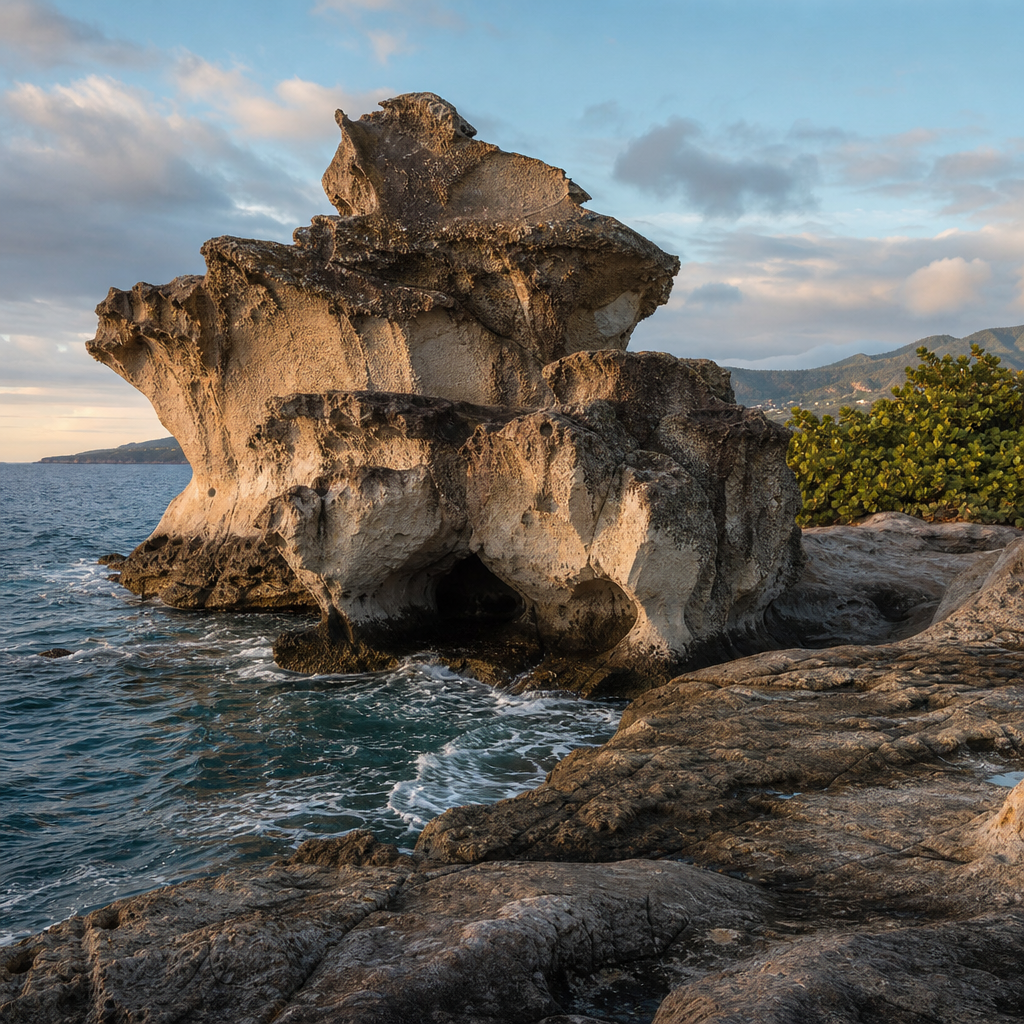
Saint Kitts’ rock formations are among the island’s most striking natural features, turning volcanic history, coastal erosion, and tropical weather into dramatic sculptures that define the landscape. In practical terms, rock formations include sea stacks, cliffs, boulder fields, lava-shaped outcrops, black-sand shore exposures, and weathered stone ridges that visitors can see from beaches, trails, and offshore viewpoints. On Saint Kitts, these landforms are not isolated curiosities. They are woven into the island’s identity, from the slopes below Mount Liamuiga to the Atlantic-facing coast where waves cut into volcanic stone day after day. For travelers, photographers, hikers, teachers, and conservation-minded readers, understanding these formations adds depth to every walk and every view.
Saint Kitts sits in the Lesser Antilles and was built largely by volcanic activity. That origin matters because the island’s bedrock, soils, and coastal shapes all reflect eruptions, ash deposits, lava flows, and later weathering. Over time, salt spray, heavy rainfall, heat, roots, and ocean force have carved the harder and softer layers differently, creating arches, angular rock faces, isolated pillars, and layered cliff sections. When people describe these places as natural sculptures, the phrase is accurate rather than poetic. The “artist” is a combination of geology and climate acting over thousands of years.
This topic matters for more than scenery. Rock formations help explain why certain beaches have dark sand, why some bays are calm and others rough, where tide pools appear, and how coastal habitats form. They also influence tourism routes, bird nesting areas, marine life shelter, and local storytelling. I have found that visitors often focus first on rainforest or beaches, then realize the island’s stone features connect both. Once you know what to look for, every outcrop becomes evidence of Saint Kitts’ deep geological past and its still-active natural processes.
As a hub for the miscellaneous side of nature and wildlife, this article covers the full picture: how Saint Kitts’ rock formations were created, where to see representative examples, what species depend on them, how to visit responsibly, and how these sites relate to wider exploration across the island. If you want one starting point before diving into specific coastal walks, volcanic landscapes, birding spots, or marine habitats, this is that guide.
How Saint Kitts’ Rock Formations Were Created
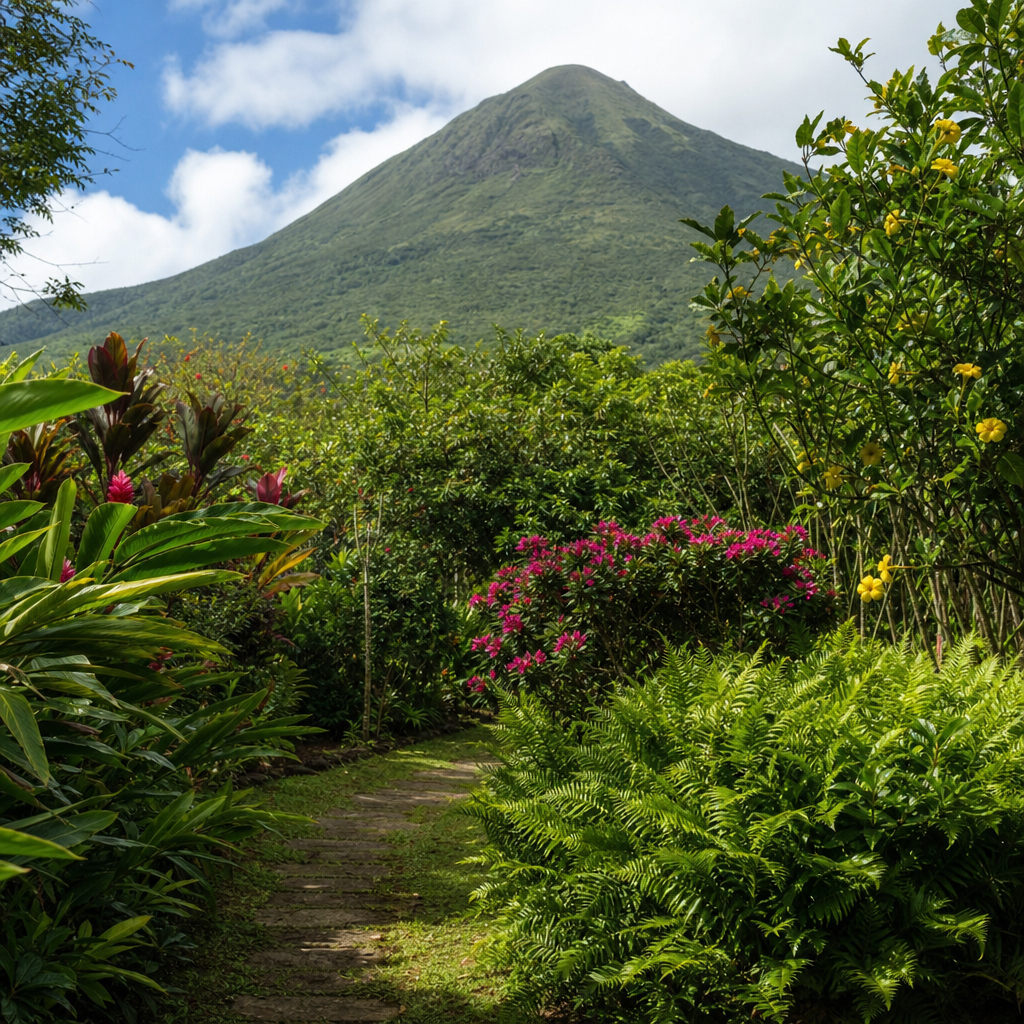
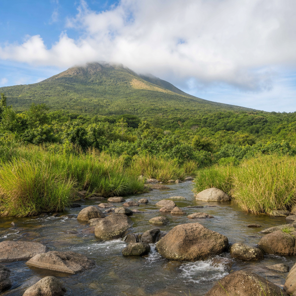
The short answer is that Saint Kitts was built by volcanoes and then reshaped by water, wind, gravity, and plant growth. The island is part of a volcanic arc formed where the Atlantic tectonic plate subducts beneath the Caribbean plate. That tectonic setting produced magma, eruptions, and the mountainous topography still visible today. Mount Liamuiga, the island’s highest peak, is the most obvious expression of that history, but smaller ridges and coastal rock exposures tell the same story in fragments.
Volcanic islands commonly contain andesite, basaltic materials, ash layers, tuff, and reworked sediments. On Saint Kitts, these materials weather at different rates. A compact lava-derived outcrop may resist erosion while adjacent ash-rich material breaks down quickly, leaving ledges, notches, and irregular silhouettes. Along the coast, wave action exploits fractures called joints, gradually widening them until sections collapse. That is how blunt headlands become jagged profiles and detached blocks become sea stacks or nearshore boulders.
Tropical rainfall is another major sculptor. Water seeps into cracks, mobilizes sediment, and accelerates slope erosion, especially after intense storms. In upland areas, vegetation helps stabilize some surfaces but can also pry rock apart as roots expand into crevices. Near the shoreline, salt crystallization weakens the stone from within. Put simply, Saint Kitts’ natural sculptures are formed by repeated stress: eruption created the raw material, and climate refined the shape.
Because the island has both Caribbean and Atlantic exposures, the style of erosion changes by coast. Sheltered western shores often show gentler beaches interrupted by rock shelves and smaller cliff faces. The more exposed Atlantic side tends to display rougher surf, harsher cutting, and more dramatic broken stone. That contrast gives Saint Kitts unusual variety in a relatively compact area, which is one reason the island rewards slow exploration.
Where to See the Most Distinctive Formations
You do not need technical training to appreciate Saint Kitts’ rock formations, but it helps to know where the landscape is most expressive. Black Rocks is the best-known starting point. Located on the northeastern coast, this area features dark volcanic boulders and fractured lava-like masses scattered where powerful Atlantic waves meet the shore. The site looks almost staged, with black stone piled and cracked into forms that resemble giant carved blocks. It is one of the clearest places to understand the island’s volcanic origin at a glance.
Another important area is the coastline near Dieppe Bay and the northern approaches below Mount Liamuiga. Here, cliffs, rocky shorelines, and surf-carved edges reveal transitions between mountain and sea. Depending on light and tide, you can see layering, broken platforms, and rounded boulders that show long exposure to wave energy. In calmer moments, tide pools and rock pockets become visible, offering a closer look at erosion in progress.
The Southeast Peninsula adds a different character. This narrower stretch of land includes exposed hills, coastal bluffs, salt pond margins, and drier terrain where weathering patterns stand out clearly. Around places such as Turtle Beach and the approach toward Cockleshell Bay, visitors can observe how stone, sand, and low vegetation interact. The formations here may be less monumental than Black Rocks, but they are valuable because they show gradual transitions rather than one iconic scene.
Even developed beach areas can reveal important details. Frigate Bay, South Friars Bay, and neighboring coves often have rocky edges or offshore outcrops that frame the sand. These smaller formations shape currents, reduce or increase wave force, and create habitat zones. In other words, some of Saint Kitts’ most useful geological lessons sit right beside places where people swim or dine.
What Each Type of Formation Tells You
Different rock formations tell different parts of the island’s story. Cliffs usually indicate resistant material or long-term coastal cutting. Boulder fields often suggest past collapse, storm transport, or exposed volcanic debris. Flat rock shelves can mark former wave-cut platforms where the sea repeatedly ground away at a consistent level. Rounded stones indicate prolonged abrasion, while jagged stones suggest fresher breakage or harder material that resists smoothing.
On Saint Kitts, dark coloration often points to volcanic origin, especially when seen at Black Rocks or in coastal exposures where black sand and stone appear together. However, not every dark rock is the same composition, and weathering can alter color significantly. Red-brown staining may reflect oxidation, while pale crusts can indicate salt and mineral deposits. When I guide readers through these sites, I stress observation before assumption: shape, grain, fracture pattern, and setting matter more than color alone.
Rock arches are less common and more fragile on small volcanic islands, but smaller cavities, notches, and partial overhangs are common signs of active marine erosion. Sea stacks form when a section of headland becomes isolated. Over time, stacks may collapse into low reefs or submerged hazards, showing that these “sculptures” are temporary on a geological clock. That temporary nature is important. The coastline of Saint Kitts is not fixed. It is constantly being edited.
| Formation type | How it forms | What you can learn from it | Common Saint Kitts setting |
|---|---|---|---|
| Cliff face | Wave cutting and slope retreat | Relative rock resistance and coastal exposure | Atlantic-facing coasts, northern shore |
| Boulder field | Rockfall, volcanic debris, storm movement | Past collapse events and high-energy surf | Black Rocks, rough shorelines |
| Rock shelf | Repeated erosion at sea level | Tide action and long-term shoreline change | Shallow coastal edges, bays |
| Sea stack or isolated pillar | Headland erosion and separation | Advanced marine weathering | Exposed points and offshore margins |
| Tide pool cavity | Irregular erosion in fractured stone | Microhabitats and daily marine cycles | Rocky intertidal zones |
How Rock Formations Support Nature and Wildlife
Rock formations are not only scenic backdrops. They are working habitat. Intertidal rock surfaces support algae, limpets, small crabs, snails, and other organisms adapted to alternating wet and dry conditions. Crevices provide shelter from predators and wave force. Pools trapped in stone become miniature ecosystems where juvenile fish, shrimp, and invertebrates can survive between tides. On volcanic islands, these microhabitats are often easy to miss, but they are essential to coastal food webs.
Seabirds and shorebirds also benefit. Rugged ledges can offer perching and nesting opportunities, especially where human disturbance is limited. Offshore rocks may become resting points for terns or other coastal birds scanning for fish. The exact species present vary seasonally and by site conditions, yet the general principle is consistent: where stone creates height, shelter, or isolated space, wildlife uses it.
Marine habitats around rocky coasts differ sharply from those around sandy bottoms. Submerged rock encourages attachment by sponges, corals in suitable conditions, sea fans, and encrusting organisms. Fish often concentrate around structure because it offers feeding surfaces and protection. Snorkelers near rocky fringes frequently see more biodiversity than they expect from a quick glance above water. The shape of the coastline determines the life it can support.
On land, dry coastal slopes with exposed rock often host tough shrubs, grasses, and salt-tolerant plants. These species help stabilize thin soils and create transition zones between marine and inland ecosystems. In Saint Kitts, those transitions are especially valuable because the island contains compressed ecological gradients, from shore to rainforest, over relatively short distances.
Best Ways to Explore Safely and Responsibly
The best way to explore Saint Kitts’ rock formations depends on your goal. For broad scenic appreciation, roadside viewpoints and established beach access points are enough. For detail, guided coastal walks are better because local guides can explain geology, tide timing, and hazard zones. For photography, early morning and late afternoon provide stronger texture and contrast, especially on dark volcanic surfaces that can look flat under harsh midday sun.
Safety matters more than many visitors realize. Wet volcanic rock can be extremely slippery, and rogue waves are a genuine risk on exposed Atlantic shores. Never stand on low isolated rocks during rough conditions, and do not climb unstable cliff edges for a better view. Tide pools may look shallow but often sit within fractured platforms where footing is uneven. Closed shoes with grip are more useful than sandals when exploring rocky coasts.
Responsible visitation is equally important. Avoid removing stones, shells, or tide pool life. Small actions repeated by many visitors degrade fragile microhabitats. Stay on durable surfaces where possible, and keep a respectful distance from nesting birds. Drone use should be cautious and legal, especially around wildlife and private property. If you join a local eco-tour operator, choose one that follows site-specific conservation practices rather than treating rocky coastlines as empty adventure space.
For families, the simplest approach works best: pair one accessible scenic stop such as Black Rocks with a calmer beach where children can compare rocky and sandy shorelines. That creates a practical introduction to island geology without overcomplicating the day.
Why These Formations Belong in a Wider Saint Kitts Nature Itinerary
Rock formations make more sense when linked to the rest of Saint Kitts’ natural systems. A traveler who visits Mount Liamuiga’s forested slopes, then sees Black Rocks, can connect volcano to coastline in one narrative. Someone who explores salt ponds on the Southeast Peninsula, then walks a rocky beach nearby, can see how geology influences wetlands, bird habitats, and shoreline shape. This is why the miscellaneous category matters: not every feature fits neatly into beach, mountain, marine life, or birding alone.
These formations are also ideal hub subjects because they connect strongly to other pages readers may want next: volcanic landscapes, black sand beaches, coastal wildlife, snorkeling habitats, scenic drives, hiking routes, and eco-friendly travel tips. In editorial planning, hub content should help people move naturally from broad understanding to specific exploration. Saint Kitts’ natural sculptures do exactly that because they sit at the intersection of geology, tourism, ecology, and place identity.
For repeat visitors, rock formations offer a reason to revisit familiar areas under different conditions. The same coast can look entirely different at low tide, after rain, during winter swell, or under golden evening light. That variability keeps the experience fresh while reinforcing one central truth: the island is dynamic, and its stone records change in plain sight.
Saint Kitts’ rock formations deserve attention because they reveal the island’s history more clearly than almost any other visible feature. Volcanic origins, marine erosion, tropical weathering, and ecological adaptation all meet in these natural sculptures, from the famous dark boulders of Black Rocks to quieter shelves, cliffs, and rocky coves around the coast. They are beautiful, but their value goes beyond appearance. They explain beach character, support wildlife, shape visitor experiences, and connect separate nature topics into one coherent story.
If you are planning a Saint Kitts nature itinerary, use rock formations as your framework rather than as an afterthought. Start with one iconic site, compare it with a calmer bay or peninsula shoreline, and pay attention to how stone influences waves, plants, birds, and marine life. That approach turns sightseeing into understanding. Explore carefully, follow local guidance, and let these coastal sculptures lead you deeper into the island’s wider landscapes and wildlife.
Frequently Asked Questions
What kinds of rock formations can visitors see on Saint Kitts?
Saint Kitts offers a surprisingly wide range of rock formations for a relatively small island, and that variety is one of the reasons its scenery feels so dramatic. Visitors can see steep coastal cliffs, isolated sea stacks rising from the water, scattered boulder fields, lava-shaped outcrops, black-sand shoreline exposures, and long weathered ridges that trace the island’s volcanic past. Some formations appear as sharp, rugged profiles along the coast, while others are rounded and sculpted, showing years of wind, salt spray, and heavy surf at work. In some places, the rock sits right beside calm beaches; in others, it forms the backdrop to hiking routes and elevated viewpoints. Together, these landforms create a landscape that feels both wild and deeply connected to the island’s geological history.
How were Saint Kitts’ rock formations created?
The island’s rock formations were shaped through a combination of volcanic activity and long-term erosion. Saint Kitts is volcanic in origin, so many of its most distinctive stone features began as lava flows, ash deposits, or uplifted volcanic material. Over time, the sea carved into weaker sections of the coast, tropical rains washed away softer layers, and constant exposure to wind and salt gradually refined the harder rock into dramatic shapes. That is why some areas display jagged outcrops and cliff faces, while others reveal smoother stone surfaces or separated formations such as sea stacks. Black-sand exposures and lava-derived rocks are especially strong reminders that the island’s scenery was first built by fire and then reshaped by water and weather. What visitors see today is the result of thousands of years of natural sculpting, with each coastline and hillside telling a slightly different chapter of that story.
Why are these rock formations important to Saint Kitts’ landscape and identity?
These formations matter because they do more than add visual interest; they help define the character of Saint Kitts itself. The island’s ridges, cliffs, and coastal stone features create many of the views that people associate with the destination, from dark volcanic shorelines to dramatic headlands overlooking the Caribbean Sea. They also help explain how the island was formed, linking present-day scenery to ancient geological events. In practical terms, rock formations influence where beaches develop, how waves break along the coast, and how trails and scenic overlooks are experienced by visitors. Culturally and visually, they contribute to the sense that Saint Kitts is a place where raw natural forces remain visible in everyday landscapes. Rather than existing as isolated attractions, these rock features are woven into the island’s beaches, hillsides, viewpoints, and outdoor experiences, making them central to how Saint Kitts is seen and remembered.
Where is the best way to view Saint Kitts’ rock formations?
The best way to view Saint Kitts’ rock formations depends on the type of scenery you want to experience. Coastal roads and beach areas often provide the easiest access to cliffs, exposed shoreline rock, black-sand sections, and offshore stacks. Hiking trails can reveal weathered ridges, elevated volcanic outcrops, and broader views that show how these formations fit into the island’s larger landscape. Offshore viewpoints, including boat-based perspectives, can be especially rewarding because they allow visitors to see the full shape of sea-carved features that may look less dramatic from land. Early morning and late afternoon are often ideal times for viewing because angled light brings out texture, color contrasts, and shadows in the stone. For travelers interested in photography or geology, combining beach visits, short hikes, and coastal lookouts is usually the best approach, since Saint Kitts’ rock formations are most impressive when seen in different settings rather than from a single stop.
Are Saint Kitts’ rock formations safe to explore, and what should visitors keep in mind?
Most of Saint Kitts’ rock formations can be appreciated safely, but visitors should treat them with the same respect they would give any rugged natural environment. Coastal rocks can be slippery from spray and algae, cliff edges may be unstable, and surf conditions can change quickly, especially around exposed headlands and sea-carved areas. On trails, loose stones, uneven ground, and heat can make exploration more demanding than it first appears. It is wise to wear sturdy footwear, stay on established paths where possible, avoid climbing unstable outcrops, and keep a safe distance from breaking waves. Visitors should also remember that these formations are part of a delicate natural system shaped over long periods of time, so removing rocks or damaging surfaces should be avoided. The safest and most rewarding approach is to explore thoughtfully, take in the geological detail from secure viewpoints, and allow the landscape to be experienced without disturbing the features that make it so remarkable.